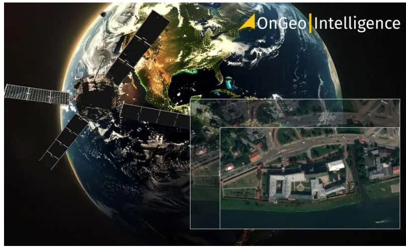
Turn Satellite Imagery into Powerful Maps That Speak Volumes

Ok, now its time to put things into practicality, In our first article, we introduced OnGeo Intelligence, a platform revolutionizing how satellite imagery is accessed — no registrations, no friction, just high-quality data at your fingertips as a way of getting accesses to spatial satellite data with ease. Then, in our follow-up, we walked through a step-by-step guide on how to order your own satellite imagery report on OnGeo, plus I shared some report samples — highlighting just how simple and code-free the entire process really is.
Now that you’ve explored the in’s and outs of the platform and even placed an order, but you want to good deeper with this innovation, you might be wondering: “What exactly can I do with my satellite report?”
Good question, this article breaks that down. Here are 8 practical and powerful things you can do with an OnGeo satellite report — whether you’re an analyst, a seasoned satellite analyst, humanitarians’ student, farmer, urban planner, or just a curious mind looking to turn imagery into insight.
Why Satellite Reporting is Important
Satellite reports are more than simply beautiful maps; they are instruments for more intelligent decision-making in daily planning and execution. Access to up-to-date, high-resolution photos enables you to see changes, predict trends, and act quickly to stay ahead of the curve in the data-driven world of today. Satellite insights give people, companies, and governments a timely, clear, and objective view of the situation, allowing them to make well-informed decisions and take the necessary action — whether that be tracking urban growth, monitoring agricultural stress, or assessing flood threats.
With platforms like OnGeo, satellite reporting is no longer reserved for large organizations with big budgets, with as little as 12$ and you are good to go. Anyone — from a student writing a thesis to a local government planner — can now tap into the power of satellite data, we are talking about quick first minus slow. The ability to instantly access and analyze historical and recent imagery opens up opportunities for better research, smarter development, and more transparent decision-making across sectors.

8 Things You Can Do With an OnGeo Satellite Report
1. Visualize Land Use Changes
Let us start with the most important aspect of a satellite report. One of the most common — and powerful — applications of satellite imagery is land use change detection. With OnGeo reports, you can compare images across different timeframes to see how a specific area has evolved. Whether you’re monitoring urban expansion, deforestation, new road networks, or shifts in land cover, the georeferenced imagery provides a clear before-and-after perspective, gain insights on what is happening on the ground without being present. This is especially useful for planners, environmental researchers, and NGOs working on land conservation or urban development.
2. Monitor Agricultural Health and Crop Performance
OnGeo satellite reports are a beneficial tool for farmers, agronomists, and agricultural researchers. By analyzing vegetation indices and visible changes in field patterns, you can assess crop health, identify stressed areas, and optimize field management- when it comes to farming every second counts especially for a successful harvest. With time-stamped data and high-resolution imagery, it’s easier to track seasonal performance, plan irrigation, and even predict yields — all without physically stepping onto the field.
3. Capture Migration Trends
Satellite imagery is increasingly being used to track migration patterns, whether it’s due to climate change, conflict, or economic shifts. By analyzing changes in population density and infrastructure development over time, OnGeo reports provide valuable insights into human migration trends.
During instances of environmental hazards, civil war, disease outbreak or natural disaster, this information can be crucial for humanitarian efforts, government policy planning, and NGOs aiming to address the needs of displaced populations or regions experiencing population growth. With OnGeo’s satellite data, you can uncover trends that might otherwise remain invisible, helping organizations and governments better plan for future challenges.

4. Assess Crop Health and Agricultural Activity
For farmers, agronomists, or anyone involved in precision agriculture, OnGeo reports provide valuable insights into crop conditions over time. By analyzing spectral imagery, you can assess vegetation health, The Normalized Difference Vegetation Index identify stressed zones, . Enhanced Vegetation Index, plan irrigation, Soil Adjusted Vegetation Index or optimize harvesting schedules, you can apply various computation with a satellite report. It’s like having an aerial agronomist in your toolkit — all without stepping into the field.
5. Conduct Environmental Assessments
OnGeo satellite reports can be a powerful tool for conducting environmental assessments. Monitoring land use, deforestation, pollution levels, water quality, and even the early warning signals of natural disasters can all be done with high-resolution photography. When it comes to urban planning and infrastructure development, environmental assessment studies are essential because in many nations and rural urban areas, they must be approved before beginning a large-scale land project like mining, farming, or construction. Environmental scientists and organizations can monitor ecological changes, the effects of human activity, and adherence to environmental regulations by routinely evaluating satellite data.
6. Plan Infrastructure Projects
For engineers and construction firms, satellite reports are invaluable when planning large-scale infrastructure projects. Before designing an infrastructure project, it is crucial to do a thorough study of the region of interest.
This is because all parties involved in the project want to know about the areas around them, as well as other significant elements like roads, trees, and nearby cities, in order to assess the project’s potential effects on the area. Insights into the topography, and environmental conditions are provided by precise satellite photography, which is useful for road construction, bridge construction, dam construction, and urban revitalization projects.
7. Support Policy Development and Decision Making
When creating regulations pertaining to land use, agriculture, disaster relief, and environmental preservation, policymakers and government organizations rely heavily on satellite imagery for up to date earth data. They require access to new, trustworthy data in order to provide appropriate and accurate reports for policy making and analysis. Decision-makers can track trends, evaluate the effects of existing policies, and forecast future requirements by examining data across time.
8 Create Maps and Visual Reports
And last but not least- however it is simple and very effective. One of the most practical uses of an OnGeo satellite report is the ability to transform raw imagery into compelling maps and visual reports in order to discover insights and analytics. Each report comes with georeferenced graphic files that can be easily imported into GIS software like QGIS or even viewed in standard graphic programs.
Final Thoughts
OnGeo’s satellite reports offer a wealth of opportunities for a wide range of industries and individuals. From urban planning and agriculture to environmental conservation and policy development, the possibilities are vast as geospatial satellite analysis continues to cause waves in this sector. By integrating these insights into your workflow, you gain a deeper understanding of the world around you, enabling smarter, data-driven decisions for every day purposes, this will go a long way in understanding the world better via satellite imagery. Regardless of their technical expertise, novices and experts alike can use satellite images in creative ways because of its effective platform.
Learn more From Download to Insight: 8 Things You Can Do With an OnGeo Satellite Report