Part 2: Reducing Conflicts
Network Connectivity

The provision of connected and consistent facilities for pedestrians and bicyclists can reduce conflicts among modes and encourage higher levels of walking and bicycling. Walking and biking routes should form a comfortable network for all ages and abilities.
The network must enable a comfortable trip from beginning to end to maximize use. To accomplish this, disconnected street networks, highway or railroad barriers, high-crash or uncomfortable intersections, and difficult midblock crossings must be addressed. Appropriate treatments along roadways vary widely based on context.
The pedestrian network is a connected transportation system made up of components such as sidewalks, street crossings, shared streets, shared use paths, and in some cases paved shoulders. The bicycle network is a connected system made up of facilities such as separated bike lanes, bike lanes, bicycle boulevards, low-volume streets, shared use paths, and paved shoulders. Pedestrian and bicycle networks should allow people to access any destination including mixed-use developments, transit stations and stops, commercial districts, residential areas, and employment centers. Pedestrian and bicycle facilities are particularly important where destinations are located in close proximity and short trips are likely.
Common Users in Conflict

Guiding Principles to Reduce Conflicts
Safety
The design of pedestrian and bicycle network facilities should decrease the likelihood and severity of all crashes.
Accommodation and Comfort
Pedestrian and bicycle facilities should create a comfortable walking and biking environment for all ages and abilities.
Coherence
Pedestrian and bicycle network facilities should be delineated and continuous throughout the user’s trip.
Predictability
Pedestrians and bicyclists should travel on predictable, defined facilities.
Context Sensitivity
Pedestrian and bicycle facilities should be appropriate to the surrounding environment.
Experimentation
Designers should consider innovative solutions to create connected networks, particularly at crossing locations where conflicts are more likely and on higher-speed streets.
Design Strategies
Pedestrian and bicycle networks are planned at many scales from region-wide route systems to small-area plans. The following strategies address the challenges and potential solutions to improve nonmotorized access to a major destination in a suburban region. These network challenges are common in many communities that were constructed with minimal consideration for walking or bicycling needs. For additional destination considerations, refer to the design topics on School Access, Multimodal Access to Existing Transit Stations, and Multimodal Access to New Transit Stations.
Disconnected Street Networks
Typical suburban street networks are a combination of major arterials and cul-de-sac developments that create challenges for bicyclist and pedestrian circulation. Cul-de-sac street networks force people to use the higher-volume, higher-speed arterials rather than the low-volume, local streets. These street networks lengthen trip routes to the point that people are less willing to bike or walk.
Considerations
- Keep block sizes small to reduce pedestrians walking through parking lots or other undeveloped areas.
- Connect cul-de-sac street networks through a system of shared use paths providing key links.
Barriers
Limited-access highways and railroad tracks can create major barriers for people on foot and bike. Infrequent barrier crossings create excessive distances for pedestrians and bicyclists. Adding barrier crossings such as bridges and tunnels will improve network connectivity, provide safer and more comfortable crossings, and reconnect bisected communities. For more information, refer to the design topic on Bridge Design.
Pedestrian Connections
A well-developed pedestrian network promotes walking trips by providing facilities that are connected, comfortable, and appropriate for their street type.
A lack of appropriate pedestrian facilities can result in people walking in the street, running across the street, or walking on private property. Higher-volume multilane roadways require pedestrians to cross four or more travel lanes at intersections. Long crossing distances expose pedestrians to potential conflicts and create a psychological barrier to walking.
Considerations
- Provide sidewalks on both sides of the street, especially higher-volume, higher-speed roadways. For more information, refer to the design topic on Accessibility.
- Narrow travel lanes and construct curb extensions and/or pedestrian crossing islands to reduce crossing distances. For more information, refer to the design topics on Design Criteria and Lane Width, Enhanced Crossing Treatments, and Intersection Geometry.
- Consider enhanced treatments, such as pedestrian hybrid beacons or Rectangular Rapid Flash Beacons, at uncontrolled crossings. For more information, refer to the design topic on Enhanced Crossing Treatments.
- Provide pedestrian countdown signals and accessible pedestrian signals at signalized crossings. For more information, refer to the design topic on Signalized Intersections.
Bicycle Connections
A well-connected bicycle network can encourage people to bike to key area destinations. In addition to appropriate facilities along segments, high-quality networks include safe and comfortable intersection crossings and connections between facilities.
Considerations
- Provide separated bike lanes on higher-volume, higher-speed roadways. For more information, refer to the design topics on Separated Bike Lanes and Separated Bike Lanes at Intersections, as well as the FHWA Separated Bike Lane Guide 2015.
- Provide standard bike lanes to define space for bicyclists. For more information, refer to the AASHTO Bike Guide 2012.
- Provide bicycle boulevards on low-volume, low-speed roadways. For more information, refer to the design topic on Slow Streets.
- Provide paved shoulders on rural roadways. For more information, refer to the design topic on Paved Shoulders.
- Consider enhanced treatments, such as bicycle signals or Rectangular Rapid Flash Beacons, at uncontrolled crossings of higher-volume, higher-speed roadways. For more information, refer to the design topic on Enhanced Crossing Treatments.
Shared Use Path Connections
Regional paths can serve as major components of the transportation network. Paths connecting to important destinations can increase the number of people walking or biking there. Providing a shared use path connection with wayfinding can connect the path users to the destination comfortably. For more information, refer to the design topics on Shared Use Paths and Midblock Path Intersections.

Wayfinding and Signs
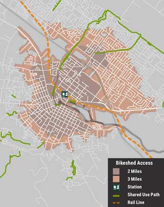
Wayfinding signs can be used to direct pedestrians and bicyclists to key destinations via low-stress routes. Curvilinear street networks, such as those shown above, can be disorienting to pedestrians and bicyclists. Wayfinding signs can help overcome this challenge. Off-street paths are sometimes difficult to locate, so adding signs can be especially helpful to provide connectivity within and between neighborhoods. Signs should comply with the MUTCD.
Route-Selection Applications
Route-selection applications, which allow users to identify routes by entering their origin and destination, are now available on most mobile devices. Developers are currently building options within applications that allow users to optimize their bicycle route for different characteristics. For example, some riders may feel comfortable sharing a higher-volume roadway with automobiles. Other riders may want to avoid those streets and optimize their route accordingly. Applications developed by public agencies must meet accessibility requirements.
Case Studies
Bicycle Master Plan
Fort Collins, CO

Source: FC Bikes, City of Fort Collins
Creating connections between existing comfortable streets and trails guided the development of the Fort Collins bicycle network. These “low-stress” facilities consist of low-volume and low-speed local streets, local streets with bike lanes, and wide, paved shared use paths. Planning focused on locations where these streets cross major arterials without signalization or where streets are offset across an arterial. Design recommendations for these locations vary but emphasize creating shorter crossing distances and making drivers aware of bicyclists’ presence. Where existing low-stress segments were not present, more robust treatments such as separated bike lanes were recommended on higher-speed arterials.
Street Connectivity Policy
Charlotte, NC

Source: Charlotte Department of Transportation
The City of Charlotte undertook a connectivity planning effort starting in 2006 to overcome the mobility and access challenges created by its disconnected street network. An initial project identified 20 high-priority areas within the city where barriers precluded convenient pedestrian and bicyclist access. In 2007, the City launched a capital program with the purpose of connecting local streets.
The City’s connectivity efforts are supported by Charlotte’s subdivision ordinance. These regulations prohibit the use of cul-de-sacs in street network design except where geographic or topographic barriers necessitate their use. In such cases, a pedestrian and bicycle connection may still be required where the street network is fragmented. Cul-de-sacs are also prohibited in transit station areas where pedestrian connections are prioritized.
For More Information
American Association of State Highway and Transportation Officials. Guide for the Development of Bicycle Facilities. 2012.
American Association of State Highway and Transportation Officials. Guide for the Planning, Design, and Operation of Pedestrian Facilities. 2004.
Federal Highway Administration. Manual on Uniform Traffic Control Devices. 2009.
Federal Highway Administration. Guidebook for Pedestrian and Bicycle Performance Measurement. 2016.
Federal Highway Administration. Separated Bike Lane Planning and Design Guide. 2015.
Institute of Transportation Engineers. Recommended Design Guidelines to Accommodate Pedestrians and Bicycles at Interchanges. 2014.
National Association of City Transportation Officials. Urban Bikeway Design Guide. 2014.
National Association of City Transportation Officials. Urban Street Design Guide. 2013.
School Access

Families and staff traveling to and from school generate significant weekday traffic-whether by foot, bike, school bus, public transit, and private vehicle-for concentrated periods (typically within a 20-minute timeframe). As community gathering spaces, schools may also generate evening and weekend travel.
As multiple travel modes intersect around the school zone, conflicts often occur on the school site and at intersection or driveway crossings nearby. Children walking or biking to school are particularly vulnerable. Designers should give consideration to vehicle speeds, intersection geometry, crossing treatments, and pedestrian and bicycle facilities along key routes to school. Education and enforcement should encourage proper driver, pedestrian, and bicyclist behavior.
Compared to new schools, which are typically located farther from neighborhoods on larger sites, constraints at older schools may limit the the ability to provide separate space for all modes. However, careful planning and design of transportation networks around both older and newer schools can encourage pedestrian and bicycle travel, reduce multimodal conflicts, and make travel more efficient. Encouraging walking and bicycling to school can improve academic performance (Active Living Research 2015), community health, and reduce vehicle traffic. In practice, schools with infrastructure improvements prioritizing bicyclists and pedestrians had an 18-percent increase in travel by those modes (McDonald et al. 2014).
Common Users in Conflict and Typical Crash Types

Guiding Principles to Reduce Conflicts
Safety
Facilities around schools should minimize conflicting movements for different modes and slow speeds to mitigate the impacts of conflicts where they may occur.
Accommodation and Comfort
The unique needs of children, as well as their parents, who are traveling by different modes to school should be considered.
Coherence
Facilities should clearly delineate a path of travel that is recognizable and highly visible to children.
Predictability
Children’s walking and bicycling travel patterns may be less predictable than those of adults, so school areas must be designed to encourage predictable behavior.
Context Sensitivity
Children’s smaller size should be considered to ensure clear sight lines in any land use, environment, or traffic context.
Experimentation
Design schools to prioritize access by walking and biking and use creative methods to encourage children, as well as staff, to walk or bike.
Design Strategies
Many school sites are designed primarily for ease of access by motor vehicles. As a result, conflicts often occur on school sites between people who walk or bicycle to school and those who drive. This is a particular problem considering that many school systems do not offer bus service to students who live in close proximity to the school, creating a great need to address walking and bicycling issues along routes that lead to schools, as well as in school zones (streets that directly abut school sites).
On-Site Improvements
To reduce conflicts among modes, separate space should be provided on the school site for pedestrians and bicyclists, bus riders, staff parking, and those picked up or dropped off by private vehicles to safely access school entrances.
Considerations
- Pedestrian and bicycle routes should be continuous and lead directly to school entrances.
- Conflict points between modes should be minimized by moving bus stops or relocating pickup and dropoff loops to maintain separation.
- Sidewalks on-site should be a minimum of 8 feet wide to accommodate high pedestrian volumes (FHWA 2006).
- Shared use paths on-site should be a minimum of 11 feet wide to reduce conflicts between pedestrians and bicyclists. For more information, refer to the design topic on Shared Use Paths.
- Driveways should prioritize pedestrians and bicyclists by maintaining the grade of an intersecting sidewalk or shared use path and altering the grade of the motorist’s path of travel.
- Driveway flare radii should be minimized to ensure slow vehicle turning speeds and to reduce the exposure time for pedestrians.
- School bus loading zones should be designated clearly with signs and pavement markings. Children should be dropped off curbside, directly onto the sidewalk.
- Private vehicle pickup and dropoff zones should be designated clearly with signs and pavement markings. The pickup and dropoff area should not require children to walk between vehicles or have vehicles straddle a pedestrian crossing.
- Bicycle parking racks should be provided as close as possible to school entrances, without creating conflicts with pedestrians.
School Zones
School zones may be designated and identified with signs and pavement markings as outlined in the MUTCD. School zones may specify a reduced speed limit during school hours or when children are present. Periodic school zone enforcement is a common and effective method for reducing speeds in school zones. (MUTCD 2009, Sec. 7B.08-7B.10)
Street Crossings
Street crossings, whether controlled or uncontrolled, are the areas of common conflict between modes in school zones.
Considerations
- Crossings should promote predictable movements and be accessible for all pedestrians. For more information, refer to the design topic on Accessibility.
- Crosswalks should be marked with high-visibility ladder-style crosswalks (MUTCD 2009, Sec. 3B.18). Consider crossing guards to maximize safety at locations with challenging pedestrian and bicycle conditions.
- Crossing distances should be shortened by narrowing travel lanes, adding a pedestrian crossing island, or adding curb extensions to allow for slower moving children and adults to cross safely.
- Uncontrolled crossings should be identified clearly with well-painted pavement markings, warning signs, or other enhanced treatments such as Rectangular Rapid Flash Beacons or raised crosswalks that alert drivers to the crossing location. For more information, refer to the design topic on Enhanced Crossing Treatments and Midblock Path Intersections.
- At signalized crossings, signal timings need to accommodate children who tend to walk slower and in large groups. Pedestrian phases should be protected from turning vehicles and set to pedestrian recall, such that the pedestrian phase comes up every cycle. For more information, refer to the design topics on Turning Vehicles and Signalized Intersections.

Education and Outreach
Infrastructure improvements should be supplemented with education to encourage proper behavior by drivers, pedestrians, and bicyclists. Everyone who accesses the school site-students, parents, staff, bus drivers-should receive clear direction on how to access the school campus at arrival and dismissal. When new walking and biking infrastructure is constructed near the school, outreach should be conducted to the school community through pamphlets and social media to familiarize all users with its intent and proper use.
Crossing Guards
Adult school crossing guards play an important role for children and families who walk or bicycle to school. Young children may lack the motor and cognitive skills required to safely navigate street crossings. By helping students cross the street safely at key locations, crossing guards can help parents feel comfortable about their children walking or bicycling to school. Crossing guards provide a visual cue to drivers that children are present and, by example, help children to develop the skills necessary to cross streets safely.
Inter-Jurisdictional Coordination
While streets and sidewalks adjacent to school sites are typically designed and controlled by city or State transportation agencies, school sites themselves may be controlled by a separate jurisdiction or school district. Cooperation between school districts and other governmental agencies, including both infrastructure and programmatic strategies, is key to decreasing harmful conflicts in school areas.
Case Studies
Discovery Elementary School
Arlington, VA
Example walking and biking routes to Discovery Elementary School

Source: Arlington Public Schools, Arlington, VA
In September 2015, Arlington Public Schools in Arlington, VA, opened the doors to Discovery Elementary School, a new school built on the same site as an existing middle school, Williamsburg Middle. Throughout the planning and design of the new school, Arlington Public Schools worked diligently to provide safe and efficient access for students and staff to walk or bike to school and to mitigate the traffic and parking impacts of the two schools on the surrounding neighborhood.
Key features of the combined campus include multiple sidewalk connections to the school site, an organized on-campus sidewalk network that provides efficient building access without driveway and parking lot crossings; a separate bicycle route for student bicyclists; a shared bus loop centered between the two schools, separate from the parent dropoff and pickup areas; and private vehicle student dropoff and pickup areas that contain pavement markings and directional signs to encourage proper procedures and behaviors.
In addition, Arlington Public Schools created a transportation demand management plan for the two schools, detailing programs to encourage active modes of travel to school by staff and students. The school provided parents with maps of example walking and bicycling routes to school, detailed written procedures for private vehicle dropoff and pickup, and a circulation map showing how all modes access the school site.
For More Information
Active Living Research. Active Education: Growing Evidence on Physical Activity and Academic Performance. 2015.
American Association of State Highway and Transportation Officials. A Policy on the Geometric Design of Highways and Streets. 2011.
American Association of State Highway and Transportation Officials. Guide for the Planning, Design, and Operation of Pedestrian Facilities. 2004.
Federal Highway Administration. Guidance Memorandum on Promoting the Implementation of Proven Safety Countermeasures. 2012.
Federal Highway Administration. University Course of Bicycle and Pedestrian Transportation. Publication No. FHWA-HRT-05-133. 2006.
Federal Highway Administration. Manual on Uniform Traffic Control Devices. 2009.
Institute of Transportation Engineers Technical Committee. School Site Planning, Design and Transportation. 2013.
National Association of City Transportation Officials. Urban Street Design Guide. 2013.
North Carolina Highway Safety Research Center. Safe Routes to School Online Guide. Last updated July 2015.
McDonald et al. “Impact of the Safe Routes to School Program on Walking and Bicycling.” Journal of the American Planning Association, Volume 80, Issue 2, 2014.
Multimodal Access to Existing Transit Stations

Modal conflicts at transit stations vary depending on the size of the station and nature of transit services provided. Pedestrians and bicyclists may conflict with buses at access points to on-site bus bays or along on-street bus stops. Where passenger car parking garages or lots are provided, car/bike and car/pedestrian conflicts are typical. On station sites and at approaches, conflicts between pedestrians and bicyclists can occur because these users frequently share the same facilities, including sidewalks, pathways, and crosswalks.
To address conflicts through station retrofits, planners and designers should first identify bicycle and pedestrian trip generators and catchment zones in the station’s service area. Desire lines and travel routes from each catchment zone can be evaluated for safety, comfort, and convenience. Potential conflict areas can be identified at the station and in surrounding areas.
It is important to minimize and mitigate conflicts in order to increase safety and comfort for bicyclists and pedestrians, and thereby to increase the use of these modes as a means to access transit. For safety improvements to achieve these goals, the following principles should be applied: pedestrians and bicyclists seek the most direct route possible; bicycle parking options should be secure and convenient; and infrastructure improvements should address on-site, off-site, and approaching roadways through agency and interjurisdictional coordination.
Common Users in Conflict and Typical Crash Types

Guiding Principles to Reduce Conflicts
Safety
At and around transit stations, conflicts between vulnerable road users, private vehicles, and transit buses should be reduced through the separation of modes.
Accommodation and Comfort
Access to and from the station should serve all users and provide a sense of comfort.
Coherence
Access to and from the station should be provided along a clear path of travel for each mode.
Predictability
Access routes to the station should have clear right-of-way assignments that create predictable behaviors for all users.
Context Sensitivity
The station and its surroundings should support community health, economic, and livability goals.
Experimentation
Transit agencies should consider innovative and creative solutions to address conflicts through coordination.
Design Strategies
In general, conflicts at and around transit stations can be mitigated through well-designed retrofits that prioritize direct and convenient pedestrian and bicycle circulation. Installation of barriers and creation of circuitous pedestrian and bicycle routes to the station entrance should be avoided.
Due to typically high volumes of pedestrians and bicyclists at and around transit stations, consideration should be given to separating modes as they approach the station and at the station itself. Where separation is not feasible, sidewalks should be wide enough to accommodate both bicyclists and pedestrians safely. Sidewalk width should accommodate peak period boarding and alighting volumes on a site-specific basis. Preferred dimensions range from 10- to 30-feet wide. For more information, refer to the Highway Capacity Manual.
Considerations
- Provide street crossing improvements on all legs of intersections near the station.
- Provide context-appropriate midblock crossings, if necessary, to accommodate direct pedestrian and bicycle movements to and from the station entrance. These are particularly important where local or regional bus connections stop on-street and not within the station site itself. For more information, refer to the design topics on Enhanced Crossing Treatments and Bus Stops.
- Reduce pedestrian crossing distances by installing pedestrian crossing islands or curb extensions.
- Tighten curb radii to reduce vehicle turning speeds or provide slip lanes and crossing islands to accommodate bus turning movements.
- Provide bicycle and pedestrian accommodations and wayfinding across station surface parking lots. Ensure walkways from accessible parking and loading to accessible station entrances are as direct as possible.
- Provide designated crossings at bus loading, pick-up and drop-off areas, and motor vehicle access roads.
- Align grade-separated crossing structures with pedestrian and bicycle desire lines where management of at-grade conflicts is infeasible.
- Enhance pedestrian crossings such as raised crosswalks, mitigation of poor sight distances, and other measures that will slow vehicle speeds.
- Install new sidewalks along well-worn tracks on grass (goat paths) that enter or cross portions of the station site.
- Provide direct bicycle connections to the station via separated bike lanes or shared use paths along desire lines that are not served by streets.
- Ensure that nearby paths and trails are linked to the station and that wayfinding signs are provided.
- Provide bike channels-flat ramps parallel to the stairs on which bicycles can be rolled-on stairways to minimize conflicts with users of pedestrian ramps. Handrail designs must meet current accessibility standards. For more information, refer to the design topic on Bridge Design.
- Separate bicyclists from bus-only access roads and driveways on the station site, where possible, by providing adjacent parallel bicycle routes.
- Minimize dismount zones-locations where bicycle riding is prohibited or discouraged. Their use should be limited to station lobbies, concourses, and areas with consistently high pedestrian volumes.
Bicycle Parking
Bicycling serves as a first- and last-mile connection to transit stations. As a result, transit stations should provide ample bicycle parking to accommodate both short- and long-term needs.
Considerations
- Provide a variety of parking options, such as high-quality access-controlled parking areas, on-demand lockers, and enclosed bike racks.
- Locate bicycle parking along or easily visible from the bicycle access routes leading to the station entrance.
- Distribute bicycle parking equipment on the station site to conveniently serve all bicycle access routes.
- Locate rack parking as close as possible to the station entrance, without creating conflicts with pedestrians in heavy pedestrian flow areas.
- Lockers and high-quality access-controlled bicycle parking may be located further from the entrance, but should be adjacent to primary bicyclist access routes.
For more information, refer to the design topics on Transit Conflicts, Traffic Calming and Design Speed, Network Connectivity, Intersection Geometry, and Separated Bike Lanes.

Maintenance
Good surface quality is essential for sidewalks and paths. Maintenance should be conducted routinely to eliminate uneven pavement surfaces and trim vegetation. During winter months, sidewalks and paths should be cleared of snow and ice to maintain access for pedestrians and bicyclists.
Inter-Jurisdictional Coordination
Transit stations are typically owned and maintained by transit agencies while the adjacent streets may be owned and maintained by local and State highway agencies. To provide a continuous pedestrian and bicycle network to the station entrances and exits, jurisdictional coordination is necessary. Agencies should conduct joint walking and biking assessments for the stations and surrounding networks to determine potential safety improvements and identify the responsible agencies for all the improvements.
Accessibility
All transit stations need to meet all Federal accessibility standards as adopted by U.S. Department of Justice and U.S. Department of Transportation. For more information, refer to the design topic on Accessibility. When retrofitting an existing transit station to comply with accessibility requirements, consider broader bicycle and pedestrian access and safety needs. Ensure that pedestrian ramps support other users on wheels such as pedestrians with strollers, push scooters, and bicyclists.
Case Studies
Washington Metropolitan Area Transit Authority Access Plan
Washington, DC Metro Area

The Washington Metropolitan Area Transit Authority (WMATA) conducted a system-wide assessment of pedestrian and bicycle access for all 86 Metrorail stations. WMATA evaluated each station site’s access, including the provision of bicycle parking, as well connectivity within 0.5 to 1 miles from station entrances. These efforts resulted in more than 3,000 individual projects across 30 types of deficiencies and recommendations. Example recommendations included barrier removal, nonmotorized access through parking lots, dirt-to-concrete path conversion, pedestrian amenities, accessible ramps, lighting, covered bicycle parking, and more.
WMATA prioritized projects into its Pedestrian and Bicycle Element of the 2012-2017 Capital Improvement Program. Projects with immediate public safety implications were addressed first using WMATA staff and on-call contractors.
Massachusetts Bay Transportation Authority Bicycle Parking
Boston, MA Metro Area

The Massachusetts Bay Transportation Authority (MBTA) received funding through the American Recovery and Reinvestment Act to plan and design high-quality bicycle parking facilities at priority transit stations. A detailed station inventory analysis was performed to evaluate existing bicycle parking needs for each bus, rapid transit, and commuter rail station within the system. Site-specific design treatments were developed to maintain access and circulation to and from the bicycle parking facility, siting the bicycle parking facility in a safe and visible location, and maximizing the number of bicycle parking spaces at each transit station. Bicycle parking recommendations included Pedal & Park facilities, which are high-quality access-controlled secure bicycle racks, and Bike Port facilities which are covered bicycle racks.
For More Information
Association of Pedestrian and Bicycle Professionals. Bicycle Parking Guidelines. 2010.
Federal Highway Administration. Delivering Safe, Comfortable, and Connected Pedestrian and Bicycle Networks: A Review of International Practices. 2015.
Federal Highway Administration. Pedestrian Safety Guide for Transit Agencies. 2008.
Transportation Research Board. Highway Capacity Manual. 2010.
Transportation Research Board. Report 153: Guidelines for Providing Access to Public Transportation Stations. 2012.
Transportation Research Board. “TCRP Web-Only Document 44: Literature Review for Providing Access to Public Transportation Stations.” Submitted March 2009.
United States Access Board. Proposed Guidelines for Pedestrian Facilities in the Public Right-of-Way. 2011.
Multimodal Access to New Transit Stations

An effective public transit network enables people to access rail and bus stations by bicycling, walking, and feeder transit services. Accommodating a wide variety of access modes at transit stations, including pick-up and drop-off areas and motor vehicle parking at suburban stations, increases ridership and fare revenue. However, it also increases the potential for conflicts between modes.
For newly constructed transit stations, it is important to have station access in place for all travel modes at the opening of the station; retrofitting once opened can be difficult. It is recommended to establish a modal hierarchy and design transit stations for vulnerable road users first. This hierarchy should be applied to minimize conflicts between vulnerable road users and other station users such as buses and other transit vehicles, private vehicles accessing pick-up and drop-off areas, and private vehicles parking at the station. The new station configuration should communicate this hierarchy.
Refer to the design topic on Multimodal Access to Existing Transit Stations for strategies to retrofit existing transit stations and reduce conflicts. This design topic focuses on pedestrian and bicycle access to new rail transit stations. Additional considerations may be necessary for bus rapid transit stations.
Common Users in Conflict and Typical Crash Types

Guiding Principles to Reduce Conflicts
Safety
Through site design at transit stations, the likelihood of crashes between transit vehicles, private vehicles, pedestrians, and bicyclists should be reduced.
Accommodation and Comfort
Station access should be comfortable and accommodate all travel modes.
Coherence
The station should have a clear path of travel to station entrances and exits.
Predictability
Circulation facilities on the station site should have clear right-of-way assignments that create predictable behaviors for all users.
Context Sensitivity
The station should be consistent with and support adjacent land uses.
Experimentation
Transit agencies should consider station access for all modes during the planning stages of new station.
Design Strategies
Transit stations should be designed using a clear modal hierarchy, making it most convenient to walk or bike to the station. To understand desire lines for a new transit station, planners and designers can conduct a walk and bike shed analysis and/or pedestrian and bicycle assessment. For more information, refer to the design topic on Network Connectivity and the U.S. Department of Transportation Pedestrian and Bicyclist Road Safety Assessments Summary Report. Based on the shed analysis, the station layout can be developed to prioritize pedestrian and bicycle access routes, ensure accessibility requirements, and reduce conflicts with other modes.
Transit stations are typically owned and maintained by transit agencies while the adjacent streets may be owned and maintained by local or State highway agencies. During the planning of transit stations, inter-jurisdictional coordination is necessary to ensure that access for all modes is functional and safe when the station opens. Jurisdictions should consider pedestrian and bicycle access to station entrances and exits from nearby destinations and future developments.
Reduce Conflicts with Private Vehicles
In the planning and design process, conflicts among private vehicles, pedestrians, and bicyclists should be avoided where possible and mitigated where it is unavoidable.
Considerations
- Configure private vehicle parking lots and garages so that they do not block direct pedestrian and bicycle desire lines to the station entrance.
- Design surface parking lots to include walkways and bikeways across the lot for safe passage. Where needed, design parking garages for safe pedestrian and bicycle through movements.
- Provide bicycle and pedestrian crossings of access roads and driveways leading to private vehicle parking lots and garages.
- Configure passenger pick-up and drop-off areas near station entrances without impeding direct access for pedestrians and bicyclists.
Reduce Conflicts with Buses
Site planning for new transit stations should minimize conflicts between buses, pedestrians, and bicyclists. Buses are wider, have larger turning radii, and larger blind spots than private vehicles.
Considerations
- If the station includes a bus terminal, provide pedestrian access between bus bays.
- If avoiding a conflict is not feasible, provide traffic calming measures that encourage drivers to maintain safe speeds on station sites.
Address Potential Barriers
Pedestrians and bicyclists usually choose the most direct path to a station, even if it means crossing roadways away from designated crosswalks or cutting through private property. When developing a transit station site plan, consider how to incorporate these desire lines and encourage compliance.
Considerations
- Use pedestrian and bicycle bridges and tunnels, and well-designed at-grade crossings to ensure that immovable barriers such as major highways, interchange ramps, arterial roads, railroad lines, streams, and secure institutions do not become barriers to direct access.
- Avoid the creation of unsafe pedestrian conditions and the degradation of permeable landscapes by locating and designing stormwater facilities, tree plantings, and landscaped areas to enhance, not block, direct pedestrian and bicycle access to the station.
- Ensure that transit-oriented development on, and immediately adjacent to, the station site is configured for convenient public pedestrian and bicycle access.
Access for Bicyclists
Considerations
- Provide separated bike lanes or shared use paths to station entrances.
- Ensure that nearby paths and trails are linked to the station and that wayfinding signs are provided.
- Provide appropriate bicycle facilities on station access roads that serve mixed traffic. Separate bicycle and bus access routes to maintain safety and comfort.
- Install covered U-style bicycle racks near station entrances.
- Consider installing high-quality access-controlled bicycle parking facilities within the station.
- In locations where additional development in the station service area is expected, plan sufficient space on-site where bicycle parking can be expanded to accommodate growing demand.
- Consider space for location of bicycle sharing systems.
- On station sites that have multiple level station designs, provide bike channels on stairways to enable bicyclists to use direct routes. Handrail designs must meet current accessibility standards. For more information, refer to the design topic on Bridge Design. To minimize conflicts with pedestrians and persons with disabilities, plan elevator car sizes to accommodate standard bicycles.

Wayfinding
Wayfinding signs for pedestrians and bicyclists increase psychological comfort, guide them to the safest routes, and enable them to focus on safe travel behavior rather than route navigation. In general, signs should be provided on bicycle routes to stations along non-arterial routes of 0.5 miles or longer. Provide pedestrian wayfinding at spot locations within 0.25 miles of the station. Signs should be compliant with the MUTCD and PROWAG.
Safety and Security
New transit stations should apply Crime Prevention Through Environmental Design concepts to increase pedestrian safety and comfort such as lighting, appropriate landscape design, and use of fencing. Pedestrian and bicycle access routes should be well-lit through parking garages to accommodate direct pedestrian and bicycle movements to the station entrance. Additionally, adjacent land uses should have direct and convenient bicycle and pedestrian access to the station site and station entrance.
Case Studies
Wiehle-Reston East Metrorail Station
Reston, VA


The Washington Metropolitan Area Transit Authority completed a system expansion opening five new stations on the Silver Line in July 2014. The current end-of-line station, Wiehle-Reston East, sits in the middle of the Dulles Access Road. Station access is from either side of the roadway using elevated walkways. The Washington & Old Dominion Trail runs just north of the station, offering both pedestrians and bicyclists easy access to the station. The new station has bicycle racks, lockers, and a state-of-the-art high security, indoor bicycle parking station. The station also contains a bus-only entrance for local and regional buses with separate vehicular access to the pick-up and drop-off area and daily parking garage.
The Federal Transit Administration convened an on-the-ground pedestrian and bicycle network safety assessment in May 2015. The assessment included Federal, State, regional, and local agency officials, along with local stakeholders and advocates. Working in teams, traveling by foot, by wheelchair, and by bike, the assessment identified improvements to the pedestrian network, bicycle network, and intersections.
Through jurisdictional coordination, the wide major arterials that sit between the station and surrounding areas continue to be improved to provide safe, accessible, and comfortable pathways to the station for pedestrians and bicyclists.
Central Station
Utrecht, the Netherlands

Source: Linda Dell’Omo, Alice in the Netherlands
Central Station in Utrecht, the Netherlands has constructed an indoor bicycle parking facility with 4,200 bicycle parking spaces. This facility was constructed as part of a rehabilitation of the transit station where a three-story bicycle parking facility is located. With over 900 trains leaving the station daily, approximately 40 percent of train passengers travel to the station by bicycle, creating a demand for high-quality bicycle parking facilities. Bicycle access to the parking facility is conducted with separated bike lanes that lead to the station without conflicting with pedestrian station access.
For More Information
Association of Pedestrian and Bicycle Professionals. Bicycle Parking Guidelines. 2010.
Federal Highway Administration. Delivering Safe, Comfortable, and Connected Pedestrian and Bicycle Networks: A Review of International Practices. 2015.
Federal Highway Administration. Manual on Uniform Traffic Control Devices. 2009.
Federal Highway Administration. Pedestrian Safety Guide for Transit Agencies. 2008.
Transportation Research Board. Report 153: Guidelines for Providing Access to Public Transportation Stations. 2012.
United States Access Board. Proposed Guidelines for Pedestrian Facilities in the Public Right-of-Way. 2011.
United States Department of Transportation. Pedestrian and Bicyclist Road Safety Assessment Summary Report. 2015.
Transit Conflicts

Source: Nathan Wilkes, City of Austin, Texas
Transportation networks in all land use settings enable people to walk, bike, and/or take transit to and from their destinations. A single trip may consist of using multiple transportation modes, for example walking to a bus stop, riding the bus downtown, and bicycling the last half mile to the office on bike share. Each transportation mode should operate safely and efficiently without negatively impacting others.
Transit conflicts can be a broad topic. This design topic focuses on conflicts between transit vehicles, such as buses and streetcars, and vulnerable road users, such as pedestrians, bicyclists, and pedestrians accessing bus stops. These principles and strategies can be applied to other modes such as bus rapid transit, subways, or heavy railroad stations.
Conflicts between transit vehicles and vulnerable road users can consist of a bus accessing a stop by crossing a standard bike lane, a bicyclist traveling across or along rail tracks, or a pedestrian or bicyclists passing a bus stop with waiting passengers. Conflicts also occur between pedestrians and motor vehicles when accessing or departing from a bus stop.
Transit conflicts may be addressed through designs that clearly delineate the path for each mode and maximize predictability between users.
Common Users in Conflict and Typical Crash Types

Guiding Principles to Reduce Conflicts
Safety
Roadways should allow safe operation of transit vehicles and vulnerable road users by minimizing potential crashes.
Accommodation and Comfort
The design should provide a sense of comfort to vulnerable road users and transit passengers while accommodating transit operations.
Coherence
The path of travel for each mode should be clearly delineated through design, pavement markings, and signs.
Predictability
The design should create predictable behaviors that allow transit vehicles, motorists, bicyclists, and pedestrians to have clear right-of-way assignments.
Context Sensitivity
Designs should respond to typical users and conflict types in a manner that complements community character and supports community health, economic, and livability goals.
Experimentation
Designers should consider innovative solutions to reducing bicycle hazards at streetcar tracks.
Design Strategies
Bus and Bike Conflicts
A common conflict between buses and bicyclists is referred to as bus-bike leapfrogging. Bus-bike leapfrogging occurs when a bus and bike are traveling on a roadway in the same direction and pass each other at multiple places. The bicyclist is traveling at a constant speed with the bus passing, pulling into a stop, departing the stop, passing the bicyclist, and traveling to the next stop. This crossing of users can create multiple instances where conflicts can occur.
Bus-bike leap-frogging is uncomfortable for bicyclists as well as for bus drivers and passengers as it can impact bus schedules. On one-way streets it may be feasible to avoid transit conflicts entirely by locating bicycle facilities on the other side of the street. Otherwise, implementation of a floating bus stop can eliminate leap-frogging, improving bicyclist’s comfort and bus operation.
Considerations
- Provide clear indication of the purpose and operations of the floating bus stop for pedestrians and bicyclists.
- Provide adequate tapers for bicyclists to transition from bicycle lane to behind the bus stop.
- Provide bus stop passengers amenities such as shelters, benches, and trash barrels outside of bicycle travel.
- Maintain accessible pedestrian access to stop amenities, sidewalk, and boarding areas.
- Provide continuous separated bicycle facility behind the boarding area. For more information, refer to the design topic on Separated Bike Lanes (FHWA Separated Bike Lane Guide 2015, pp. 92-96).
- Provide clearly marked crosswalks from the island to the adjacent sidewalk (FHWA Separated Bike Lane Guide 2015, pp. 92-96).
- Consider a raised crosswalk across the bicycle facility (FHWA Separated Bike Lane Guide 2015, pp. 92-96).
- Consider yield or stop lines and YIELD [or STOP] HERE FOR PEDESTRIANS (R1-5) signs to alert bicyclists of the passenger crosswalks (MUTCD 2009, Sec. 2B.11).

Track and Bike Conflicts
Cities are competing to provide multimodal transportation networks that focus on complete streets and public transportation options. Some have reintroduced light rail and streetcar vehicles to their transit systems. Light rail transit or streetcars, also known as trolley cars, are short public transit vehicles that run on rails on a regular schedule. Light rail transit typically operates within its own exclusive space and streetcars operate in a travel lane along a roadway. Boston, Portland, Seattle, and San Francisco are a few examples of cities that operate light rail and streetcars as part of their transportation systems.
Between the resurgence of light rail and streetcars and increases in bicycling, conflicts between bicyclists and tracks may become more common. Tracks typically contain a gap, called the flangeway, which can be a hazard for bicycle tires. In wet conditions, tracks may be slippery, causing bicyclists to lose control.
Considerations
- Consider using the best track surface material for safe bicycle travel especially when the surface may be regularly wet.
- Consider reducing the flangeway or using a flangeway filler product.
- Provide pavement markings such as bike lane lines, bike symbols, and green colored pavement surfaces to direct bicyclists to cross the tracks between 60 and 90 degrees to reduce the risk of getting bicycle tires caught in the tracks. (AASHTO Bike Guide 2012, p. 4-38)
- Consider a median to force deflection of bicyclist to cross the tracks at the appropriate angle and prevent illegal parking by motorists.
- Provide advance track warning signs to alert bicyclists of the tracks ahead.

Network
Connected networks for pedestrians and bicyclists allow convenient access to and from transit facilities including stations and bus stops. Factor in desire lines when installing new transit facilities. For more information, refer to the design topic on Network Connectivity.
Education
Educating transit vehicle drivers to be aware and cautious around vulnerable users can help reduce conflicts. Drivers should receive trainings, ideally through driving simulators, on how to operate when bicyclists and pedestrians are present. Bus drivers should be alert that the exiting passengers may cross in front of the bus. Educating bicyclists to be cautious and courteous at transit stops can help reduce conflicts. Consider installing educational signs at strategic locations such as on buses and shelters.
Bus Stop Placement
Bus stop placement is a key component of reducing conflicts between bus passengers, pedestrians, bicyclists, and motorists. Bus stops should be located at appropriate distances based on the context of the area. For example, bus stop spacing in central business districts is less than 400 feet. Bus stops should complement the sidewalk and bicycle facilities to connect passengers with the surrounding pedestrian and bicycle networks. At intersections, bus stops can be provided on the near- or far-side of the intersection. Far-side bus stops are preferred when feasible as near-side bus stops can block visibility between turning vehicles and pedestrians. At midblock bus stop locations, depending on the proximity of other crosswalks, a midblock crossing may be necessary and may require enhanced crossing treatments. For more information, refer to the design topics on Enhanced Crossing Treatments, Bus Stops, and Midblock Path Intersections. (AASHTO Transit Guide 2014, p. 5-11-5-13)
Case Studies
Directing Bikes Across Streetcar Tracks
Boston, MA

Source: Nicole Freedman
With the number of bicyclists increasing in Boston, the City has seen an increase in bicycle crashes resulting from the presence of in-street rail lines. The City decided to address the issue of bicyclist interaction with in-street rail through pavement markings and green colored pavement.
At intersections where track angles were creating challenges for bicyclists, dashed white lane lines with green colored pavement were added to help bicyclists position themselves to cross the tracks at near 90-degree angles.
Boston also has streetcars that run along the center of streets that are too narrow for exclusive bike lanes. To encourage bicyclists to stay in the right lane, the City installed shared lane markings and left-turn queue boxes to assist bicyclists in making left turns.
Floating Bus Stop
Seattle, WA

The City of Seattle has installed bus stop floating islands at a majority of bus stops along Dexter Avenue, a major bicycle commuting corridor that has peak bicycle volumes of over 300 bicyclists per hour. This 1.5-mile corridor carries buses at 10 minute headways during peak periods. The bus stop floating islands allow buses to stop in-lane, decreasing bus delay and allowing buses to easily re-enter traffic without waiting for a gap in passing motorists. The buffered bike lane is routed behind the bus stop, which prevents conflicts between bicyclists and stopped buses. The bus stop floating islands are accessible, with curb ramps and detectable warning surfaces. Some of the bus stops include railings across the back of the bus islands to encourage pedestrians to cross the bike lane at a designated point.
For More Information
American Association of State Highway and Transportation Officials. Guide for the Development of Bicycle Facilities. 2012.
American Association of State Highway and Transportation Officials. Guide for Geometric Design of Transit Facilities on Highways and Streets. 2014.
Federal Highway Administration. Guidance Memorandum on Promoting the Implementation of Proven Safety Countermeasures. 2012.
Federal Highway Administration. Manual on Uniform Traffic Control Devices. 2009.
Federal Highway Administration. Separated Bike Lane Planning and Design Guide. 2015.
National Association of City Transportation Officials. Urban Street Design Guide. 2013.
Freight Interaction

Freight movement is essential for a strong economy. Freight vehicles range from single unit box trucks to large tractor-trailer combinations. These large vehicles are wider, have larger turning radii, and more blind spots than typical passenger vehicles.
Freight vehicles have significant mass, creating the potential for serious or fatal injuries when involved in a bicycle or pedestrian collision. Data from the National Highway Traffic Safety Administration indicates that among crashes involving large trucks, 11 percent of people killed were non-occupants such as pedestrians or bicyclists (Traffic Safety Facts: Large Trucks, 2015, p. 2).
Conflicts between freight vehicles and bicyclists and pedestrians generally occur at intersections; however, midblock conflicts can also occur and are typically due to loading activities. Through roadway design, conflicts can be mitigated and the behavior of all users can be made more predictable. Education of all road users can improve the understanding of how each mode operates on roadways.
Common Users in Conflict and Typical Crash Types

Guiding Principles to Reduce Conflicts
Safety
Through engineering, education, and enforcement, roadway designers and the freight industry should consider an approach to reduce the severity and likelihood of crashes.
Accommodation and Comfort
The design should provide a sense of comfort for vulnerable road users where freight vehicles are present and accommodate freight needs specific to each corridor.
Coherence
The path of travel for pedestrians and bicyclists should be clearly delineated for freight vehicles to recognize.
Predictability
The design should maximize predictability and reduce conflicts between vulnerable road users and freight vehicles.
Context Sensitivity
The design should support community health and livability goals while maintaining and growing the economy.
Experimentation
Freight vehicles should consider innovative technologies that can alert drivers of potential conflicts with other roadway users.
Design Strategies
Commercial Loading and Unloading
Truck loading operations typically involve pulling over to the side of the roadway. This may result in blocking a bike lane or crossing through a bike lane to access a loading zone. Dedicated commercial loading zones can save trucking companies time and money and improve air quality. Consider designating commercial loading zones where they will cause minimal conflict with bicycle facilities. This should be balanced with providing convenient dedicated loading zones.
Considerations
Streets with heavy freight usage, high parking demand, and bike lanes benefit from dedicated commercial loading zones after an intersection. Loading zones may help reduce obstruction of the bike lane and make deliveries easier for businesses. These zones can be striped and signed, or managed for off-peak deliveries. (NACTO Urban Street Design Guide 2013, p. 15)
- Consider consolidating commercial loading zones to a single location on each block to reduce potential conflicts.
- Consider the length of typical loading vehicles that use the space when determining the length of the loading zone.
- The loading zone should be 8-10 feet wide.
- Where on-street parking and separated bike lanes are provided, consider a 5-foot minimum access aisle between the commercial loading zone and the bike lane. Vertical objects should be discontinued where an access aisle is provided.
- A curb ramp with a separated bike lane crosswalk can simplify loading and unloading activity.
- Green colored pavement can be used to notify freight operators of a potential conflict with a bicyclist.
- Consider locating a commercial loading zone on an adjacent block or alley where a loading zone is desired but on-street parking is not present. A lateral shift of the separated bike lane and the sidewalk should be considered as a last resort.
Loading Zone Adjacent to Standard Bike Lane

Loading Zone Adjacent to Separated Bike Lane With On-Street Parking

Loading Zone Adjacent to Separated Bike Lane Without On-Street Parking

Intersection Geometry
Designers should consider mountable truck aprons where turning movements by large vehicles are common. Mountable aprons discourage smaller vehicles from making turns at high speeds while still allowing trucks to turn without entering the pedestrian zone or adjacent vehicle lanes. They help reduce off-tracking risks to pedestrians with visual disabilities. Additional strategies for accommodating large vehicles at intersections include setting back stop lines and allowing large vehicles to encroach into adjacent lanes when turning. For more information, refer to the design topic on Intersection Geometry.
Signal Phasing
Signal phases can be used to separate or give a head start to bicycle and pedestrian movements from conflicting freight movements. Separate signal phases can be used where a primary freight route turns and a bicycle route continues straight, at intersections with a high number of freight and bicycle or pedestrian crashes, and at intersections with separated bike lanes. When using separate signal phases, the intersection must be designed so that tractor-trailer combinations can safely make a turn without encroaching on the bike lane, preferably with curb separation between the bike lane and the travel lane. To give a head start, a leading pedestrian or bicycle interval can be used to increase visibility and reduce conflicts. For more information, refer to the design topic on Signalized Intersections.
Signs
Dynamic warning signs may be used to alert freight vehicles when bicyclists are present. Dynamic signs use a loop detector to detect a bicyclist. When a bicyclist is detected, the dynamic sign illuminates to alert any potential turning vehicles to yield to the bicyclist. Signs should comply with the 2009 MUTCD. For more information, refer to the design topic on Turning Vehicles.
Mirrors, Sideguards, and Warning Systems
Mirrors and blind spot warning systems prevent collisions by decreasing the driver’s blind spots and alerting them to bicyclists or pedestrians in the blind spot. A 2007 National Transportation Safety Board (NTSB) study found that large trucks lacking right fender mirrors were disproportionately involved in serious injury and fatal collisions (NTSB Safety Recommendations 2014, p. 4).
Sideguards mitigate collisions by keeping vulnerable road users from being struck by the truck’s rear wheels in a side-impact collision. The sideguards prevent a bicyclist or pedestrian from being swept under the truck and struck by the rear wheels.
2015 Seattle Pedestrian, Bicycle, and Freight Assessment
The United States Department of Transportation (U.S. DOT) and its Federal Motor Carrier Safety Administration held a pedestrian and bicycle safety assessment focusing on freight in Seattle assessment in Seattle, Washington on May 7, 2015. The purpose of the assessment was to identify issues and conflict points involving the movement of freight vehicles and bicyclists. Throughout the day, participants were able to ride in buses and trucks, learn about the operating characteristics of various roadways users, and share their experiences as bicyclists, bus drivers, and freight operators.
A key theme in the assessment was user education. While separated bike lanes along roadways with heavy freight traffic are ideal, participants acknowledged that a cohesive network of such infrastructure would take many years to construct. In the meantime, participants agreed that education of all road users on the operational characteristics and needs of each mode is a key tool in reducing crashes between bicyclists, pedestrians, and heavy vehicles.
Participants also recognized that a variety of other components play a part including improvements in both equipment and infrastructure. Turning movements often create conflicts between freight vehicles and bicyclists. Equipment enhancements such as sideguards and audible messaging systems were presented to address this situation. Infrastructure improvements may also decrease the number and severity of conflicts between buses, freight vehicles, and bicyclists by eliminating conflicts where feasible and minimizing speed differentials. The use of bike signals to time-separate the two modes was discussed as an example infrastructure improvement.
Education
Education is an important component of reducing conflicts between freight and bicycles and pedestrians. Large vehicles need more room to make turning maneuvers than passenger vehicles and the rear wheels do not track along the same line as the front wheels. Educating bicyclists about truck movements and blind spots, as well as educating truck drivers about common bicycle and pedestrian movements, is a key component of sharing the road safely.

Case Studies
Off-Hour Delivery Program
New York City, NY

Source: Jason Kuffer (Creative Commons)
In 2009-2010, the New York City (NYC) Department of Transportation implemented an Off-Hour Truck Delivery Pilot Program. Twenty participants shifted their delivery windows to between 7pm and 6am. Receivers had no major issues with the switch; some reported increased staff productivity because staff did not have to be available to receive deliveries while they were serving customers. Carriers reported more efficient operations, fewer parking tickets, and potential to reduce fleet size by balancing day and night operations. With the success, the program, now called NYC deliverEASE, has continued to grow where team members train participants on how to make quiet deliveries and use low noise technologies.
Truck Sideguards
Boston, MA

Source: Kristopher Carter, City of Boston
A literature review performed by the Volpe National Transportation Systems Center found a 61-percent drop in bicyclist fatalities and 20-percent drop in pedestrian fatalities from side-impact truck collisions in the United Kingdom after sideguards were mandated (Truck Side Guards Resource Page 2015). In 2014, the City of Boston mandated sideguards for all city-contracted vehicles. Vehicles over 10,000 pounds and tractor-trailers over 26,000 pounds combined must have sideguards, convex mirrors, cross-over mirrors (which eliminate the truck’s front blind spot), and blind-spot awareness decals. The improvements cost approximately $1,800 (2015) per vehicle.
For More Information
American Association of State Highway and Transportation Officials. Guide for the Development of Bicycle Facilities. 2012.
Federal Highway Administration. Manual on Uniform Traffic Control Devices. 2009.
Federal Highway Administration. Separated Bike Lane Planning and Design Guide. 2015.
National Association of City Transportation Officials. Urban Street Design Guide. 2013.
National Highway Traffic Safety Administration. Traffic Safety Facts: Large Trucks. 2015.
Safety Recommendations, issued by National Transportation Safety Board to the National Highway Traffic Safety Administration, April 3, 2014.
Volpe National Transportation Systems Center. “Truck Side Guards Resource Page.” Last modified September 23, 2015.
Accessibility

Accessible pedestrian facilities improve the quality of life for those with mobility, visual, hearing, or other disabilities by reducing barriers to services, opportunities, and social activities. Pedestrian access routes, which provide continuous and clear pedestrian pathways, enhance mobility and encourage independence by increasing transportation choice.
Nearly one in five adults under the age of 65 have difficulty traveling due to a disability, with difficulty walking cited as the most common problem (Committee on Disability in America 2007, p. 522). Often the built environment is a primary reason for this difficulty because it has historically been designed for people who do not have a disability. Design details for surfaces, streetscape furniture, sidewalks, signals, street crossings, and transit stops may render pedestrian facilities inaccessible. As a result, pedestrians with disabilities may be forced to walk in the street or otherwise be placed in direct conflict with motor vehicles or bicycles.
The Rehabilitation Act of 1973 prohibits agencies receiving Federal financial assistance from discriminating on the basis of disability. Since 1990, the Americans with Disabilities Act (ADA) has required pedestrian facilities in the public right-of-way to be accessible. Accessible street designs minimize multimodal conflicts by eliminating barriers for pedestrians, communicating street crossing information, and promoting predictable behavior for all roadway users.
Common Users in Conflict and Typical Crash Types

Guiding Principles to Reduce Conflicts
Safety
Designs should eliminate conflicts by maintaining an access route on pedestrian circulation paths, which includes sidewalks, curb ramps, street crossings, and connections to accessible facilities.
Accommodation and Comfort
Designs should eliminate barriers for people with mobility, visual, hearing, or other disabilities.
Coherence
Accessible pedestrian routes must provide a continuous clear width free of obstructions and protrusions.
Predictability
Designs should provide accessible elements with consistent characteristics and in a logical arrangement to communicate the pedestrian access route.
Context Sensitivity
Designs should accommodate pedestrians with disabilities in a manner that complements community character and supports community health, economic, and livability goals.
Experimentation
Pedestrian access routes must meet Federal standards.
Design Strategies
Providing, maintaining, and connecting to pedestrian access routes is the central concept of the U.S. Access Board’s 2011 Proposed Guidelines for Pedestrian Facilities in the Public Right-of-Way (PROWAG). A pedestrian access route must provide a 4-foot minimum continuous clear width, a maximum grade consistent with the road grade, a maximum 2-percent cross slope, and a “firm, stable, and slip resistant” surface (PROWAG 2011, R302). Accessibility requirements greatly influence the design and construction strategies for sidewalks, street crossings, curb ramps, signals, street furniture, transit stations, on-street parking, loading zones, shared use paths, and more. For more information on the relationship between the current enforceable ADA Standards and PROWAG, see p. 6.
At the network level, connecting pedestrian access routes reduces conflicts by providing access across barriers. This enables safe and comfortable walking trips from beginning to end for pedestrians of all abilities. For more information, refer to the design topic on Network Connectivity for network-level design strategies including small blocks, road diets, safe crossings, and gap connectivity.
Sidewalks
Sidewalks comprise the bulk of pedestrian access routes. They should provide a continuous circulation path and connect pedestrians to accessible elements, spaces, and facilities. Where narrower than 5 feet, a 5-by 5-foot minimum passing space is required at 200-foot maximum intervals (PROWAG 2011, R302.4). To increase maneuverability, additional space should be provided at “turns or changes in direction, transit stops, recesses and alcoves, building entrances, and along curved or angled routes, particularly where the grade exceeds 5 percent” (PROWAG 2011, Advisory R302.3).
Streetscape furniture cannot be placed within the pedestrian access route (i.e., pedestrian through zone) and any nearby obstructions in the frontage and street furniture zones should be detectable by cane. For more information on sidewalk zones, refer to the NACTO Urban Street Design Guide 2013, p. 38. Protruding objects, such as wall- or pole-mounted items, must be limited because they can be difficult to detect and avoid (PROWAG 2011, R402).
Street Crossings
Street crossings maintain the pedestrian access route across travel lanes at intersections. A variety of striping may be used to denote the pedestrian crossing (MUTCD 2009, Sec. 3B.18). High-visibility ladder style crosswalks with longitudinal lines are recommended.
Ensure that adequate roadway sight distance is provided in advance of the pedestrian crossing to enhance the visibility for approaching motorists and bicyclists. As motor vehicle speeds increase, additional sight distance should be provided.
Consider additional treatments at intersections that minimize multimodal conflicts by reducing motorist turning speeds and improving motorist yielding rates. Curb extensions shorten crossing distances, prevent illegal stopping/parking in close proximity of the crosswalk, and further increase visibility of pedestrians to motorists, particularly on roadways with on-street parking. Raised crossings enhance visibility and provide an additional traffic calming benefit to encourage motorist yielding behavior. Crossing islands break up long crossings and help pedestrians manage directional conflicts. For more information, refer to the design topics on Traffic Calming and Design Speed and Enhanced Crossing Treatments.
Curb Ramps
Curb ramps facilitate pedestrian access between sidewalks and street crossings, and between sidewalks and accessible on-street parking. Curb ramps may be perpendicular or parallel to the pedestrian access route, or a combination of both, with a maximum running slope of 8.3 percent. PROWAG allows for different maximum cross slopes depending on the traffic control in place at the crossing (2011, R302.6). Ramps should align with pedestrian crossings; the use of apex curb ramps (i.e., diagonal ramps) should be a last resort, as these ramps direct pedestrians into the intersection and away from the crosswalk.
Each curb ramp must include a landing/turning space for wheelchair maneuverability and a detectable warning surface to alert pedestrians with a visual disability that they are entering or exiting the roadway. Detectable warning surfaces must include truncated domes to provide tactile feedback and must exhibit visual contrast with adjacent surfaces (e.g., light on dark or dark on light). Place detectable warning surfaces at the back of the curb, unless otherwise specified by PROWAG (2011, R305.2). Detectable warning surfaces are also needed at blended transitions (i.e., crossings with a running slope less than 5 percent) raised crossings, and at pedestrian crossing islands.
Signals
At signalized intersections, accessible pedestrian signals communicate the location of the pedestrian pushbutton and the direction and timing of WALK and DON’T WALK intervals in a non-visual format. The MUTCD defines non-visual as one or more “audible tones, speech messages, and/or vibrating surfaces” (2009, Sec. 4E.09), whereas PROWAG defines non-visual as both “audible tones and vibrotactile surfaces” (2011, R209). Designers should separate pedestrian pushbuttons by at least 10 feet and locate each near a level landing or a blended transition to “make it obvious which pushbutton is associated with each crosswalk” (MUTCD 2009, Sec. 4E.08). Consider slower walking speeds (less than 3.5 feet per second) when determining pedestrian clearance times to accommodate the elderly and pedestrians with disabilities (MUTCD 2009, Sec. 4E.06). Signal timing should allow pedestrians to cross both sides of the street during a single cycle. Designers should place a pushbutton at pedestrian crossing islands for slower moving pedestrians to call the signal if they cannot cross the street in a single cycle.

Surface Treatments
PROWAG requires planar and smooth pedestrian access route surfaces. Uneven unit pavers, rough bricks, and hand-tooled concrete control joints cause uncomfortable or even painful vibrations for people using wheeled mobility devices. Minimize vertical discontinuities between unit pavers, vault frames, gratings, and where materials intersect (refer to PROWAG 2011, R302.7, for specifications for vertical discontinuities and horizontal openings). Saw-cut concrete control joints and wire-cut bricks help reduce vibrations.
Maintenance
Proper maintenance of pedestrian access routes is essential to keeping pedestrians on the sidewalk and out of the roadway. The clear width should remain free and clear of obstructions, including signs, café seating, snow, ice, debris, and other clutter. Inspect pushbutton responsiveness and pedestrian signal indications on a routine schedule to avoid a lapse in functionality. Public reporting applications can further help identify maintenance needs.
Case Studies
Berkeley 2010 Pedestrian Master Plan
Berkeley, CA

The City of Berkeley is regarded as one of the most accessible cities in the U.S. for its early and continued efforts to provide accessible public rights-of-way. It has more than 30 years of experience incorporating accessible elements into street design, starting several years before the introduction of national ADA legislation. Both its Disability Compliance Program (BDCP) within Public Works and its Commission on Disability ensure a culture of accessibility within City government. The City retrofits approximately 100 existing curb ramps per year to contemporary design standards, and continues to install accessible elements at locations with identified safety and accessibility deficiencies. Its most recent 2010 Pedestrian Master Plan recommends accessible facilities training for all Public Works and Planning staff, a system to track ongoing efforts, and expanded oversight for the BDCP.
Oregon State University Accessibility Plan
Corvallis, OR

Oregon State University (OSU) is striving to create a universally accessible campus through a holistic approach to barrier removal using the 2010 ADA Standards and best practice performance standards. OSU’s plan (considered a “draft” document because the campus is always changing) identified five key objectives, including identifying an Accessible Travel Grid (ATG) in collaboration with the community and the OSU Accessibility Committee. The ATG is a pedestrian access route that will connect all campus facilities with at least one accessible access point. Focusing on the ATG allowed OSU to initially prioritize 1,134 barriers for resolution (out of 5,029 total barriers identified in the exterior environment), significantly reducing the implementation timeframe and overall cost of achieving an interconnected campus.
Turning Vehicles

Motor vehicles making turns at intersections can be a hazard for pedestrians and bicyclists. Data from the National Highway Traffic Safety Administration indicate that 20 percent of fatal pedestrian crashes and 34 percent of fatal bicyclist crashes occur at intersections, predominantly in urban areas (Traffic Safety Facts: Pedestrians, 2015, p. 2; Traffic Safety Facts: Bicyclists and Other Cyclists, 2015, p. 2). In a 2015 study, the City of Seattle found that the most significant crash type at both signalized and unsignalized intersections was a turning motorist crossing the path of a through bicyclist or pedestrian. Left-turning motorists accounted for 19 percent of bicyclist crashes and 31 percent of pedestrian crashes at all intersection types. Right-turning motorists accounted for 15 percent of bicyclist crashes and 17 percent of pedestrian crashes at all intersection types.
Research has found that left-turning motorists on two-way streets are focused primarily on finding gaps in oncoming traffic, and a high percentage of motorists are not looking for crossing pedestrians or bicyclists. Scanning and awareness becomes more difficult for motorists on roadways with higher speeds and multiple travel lanes.
Generally, right-turning motorists have an easier time scanning for bicyclists or pedestrians since they are less focused on finding gaps in traffic. Conflicts often result from failure to yield or bicyclists approaching from the rear in a driver’s blindspot.
Turning movement conflicts may be addressed through designs that reduce motor vehicle speeds, minimize speed differentials at conflict points, maximize visibility and predictability, raise awareness, and separate movements through time and space.
Common Users in Conflict and Typical Crash Types
Guiding Principles to Reduce Conflicts
Safety
The design should proactively address known safety issues caused by turning vehicles.
Accommodation and Comfort
Intersections should be designed to be accessible for all users and maximize comfort to the greatest extent practicable.
Coherence
Intersections should provide adequate sight distance between turning vehicles and vulnerable road users.
Predictability
The design should provide clear right-of-way to increase predictable behavior.
Context Sensitivity
The design should incorporate and support community resources, the natural environment, and adjacent land uses.
Experimentation
Intersections should use innovative solutions to increase sight distance and decrease conflicts between turning vehicles and vulnerable road users.
Design Strategies
Signalized Intersections
Traffic signals may be installed at locations where the continual flow of vehicles on one roadway results in excessive delay or hazard to crossing vehicles, bicyclists, or pedestrians. The decision to install a signal should be based on an engineering study which considers the warrants outlined in the MUTCD. Accessible pedestrian signals with countdown timers should be provided at signalized intersections to inform pedestrians when they may enter the roadway and how much time remains for their crossing (MUTCD 2009, Sec. 4E.07). A minimum pedestrian walk interval of 10 seconds should be provided except in rare circumstances where pedestrian volume is negligible (ITE Traffic Control Devices Handbook 2009, p. 381). For more information on accessible pedestrian signals, see the design topic on Accessibility.
Reducing left and right hooks can be achieved through partially or fully separating vehicle turning movements from conflicting pedestrian or bicycle movements. Partially separated movements are called leading intervals. A leading interval increases visibility and allows pedestrians or bicyclists to assert their right-of-way by providing a head start into the intersection before turning vehicles. Leading intervals are typically a minimum of 3-8 seconds in advance of the green phase for turning motor vehicles. Accessible pedestrian signals should be considered when adding leading intervals. Fully separated movements may require longer signal cycle lengths, which may result in reduced user compliance with signal indications and therefore increased potential for conflict. Cycle lengths should be minimized to reduce delay and maximize compliance. Designers should consider partially or fully separating bicycle movements from motor vehicles. At locations where conflicts are high and the provision of separate phases is not feasible or desirable, restricting vehicular turns should be considered when alternative motor vehicle routes are available. For more information, refer to the design topic on Signalized Intersections.
Crossings
Bicycle and pedestrian crossings should be separate unless designated as a shared use path crossing. A 6-foot minimum crossing island can be added to provide a refuge for pedestrians and to slow left-turning vehicle speeds. Consider wider crossing islands to accommodate bicycles with trailers, which cumulatively measure at least 9.75 feet long (AASHTO Bike Guide 2012, p. 3-4).
Pavement Markings
Pavement markings improve the predictability of movements and raise awareness of potential conflicts. For bicyclists, this may be accomplished with dotted bicycle lane lines on an intersection approach to indicate a motorist merge area, or dotted extension lines through the intersection. The dotted lines are typically 6 inches or wider and could be supplemented with green colored pavement to improve visibility. Two-stage turn boxes are used to simplify turning for bicyclists. They may require FHWA approval. For pedestrians, high-visibility ladder-style crosswalks maximize visibility of the crossing (MUTCD 2009, Sec. 3B.18).
Separated Bike Lanes
Providing additional separation between bicyclists and motorists can improve the visibility of bicyclists to turning motorists. For more information, refer to the design topic on Separated Bike Lanes at Intersections.
Signs
The TURNING VEHICLES YIELD TO (or STOP FOR) PEDESTRIAN (R10-15) sign can be installed at intersections to alert motorists of their requirement to yield or stop for pedestrians or bicyclists within the crossing. In cases where motorists need to be alert to a potential conflict with pedestrians and bicyclists, the sign can be modified to include both a pedestrian and bicycle symbol. The sign can be located at the near- or far-side of the intersection. Engineering judgment should be used to determine a location that is conspicuous to the turning driver. (MUTCD 2009, Sec. 2B.53).
Intersection Geometry
Intersection geometry has a significant impact on the safety of pedestrians and bicyclists. Ideal intersection geometry should induce yielding by slowing turning vehicles to minimize speed differentials at conflict points. Techniques include installing curb extensions, installing raised crossings, or reducing the curb radii. Consider roundabouts as an alternative to traffic signals and at intersections with complicated geometry. For more information, refer to the design topic on Intersection Geometry and NCHRP Report 672.

Education
Education campaigns can help to inform users about where to travel to be most visible to other users, where to expect other users to be traveling, and the blind spots of different users. Best practices include educational programs through Safe Routes to School, bicycle and pedestrian curriculum in driver’s education and licensing tests, and educational materials such as signs and fliers sent to residents or available at public events.

Access Management
Access management techniques can be applied to reduce the frequency of turning movement conflicts caused by driveways or streets. Typical strategies include driveway consolidation, continuous medians, directional islands to restrict left turns, and driveway or street closures. Access management techniques may be particularly beneficial to reduce crashes caused by left turning motorists. Street sections with limited driveway openings maximize comfort and safety for bicyclists and pedestrians.
Freight
Freight vehicles range in size and require large turning radii. Freight vehicles also have blind spots creating challenges for vulnerable road users. For more information, refer to the design topic on Freight Interaction.
Case Studies
Massachusetts Avenue at Beacon Street
Boston, MA

In 2015, at the intersection of Massachusetts Avenue and Beacon Street in Boston, a through bicyclist was struck and killed by a right turning truck. As part of their Vision Zero Initiative to reduce traffic injuries and fatalities, the City of Boston quickly implemented short-term intersection improvements. By obtaining the latest three years of crash data, the City was able to respond with countermeasures to reduce crash patterns at the intersection. Improvements included removing a right turn lane to provide a separated bike lane, optimizing signal timings, providing leading pedestrian intervals, extending bicycle lanes through the intersection with high visibility green-colored pavement markings, adding a bicycle box, and adding signs for motorists to yield to pedestrians. The City will continue to monitor the intersection and plans to develop long-term recommendations to improve safety along the entire corridor.
Bicycle and Pedestrian Safety Analysis
Seattle, WA

Seattle is undertaking a robust collision and roadway data analysis to identify the factors that contribute most significantly to pedestrian and bicycle collisions. The findings of this analysis are anticipated to help Seattle proactively address safety issues through systemic improvements and uniform street design approaches. Preliminary results indicate that relatively few combinations of driver and bicyclist or pedestrian actions account for most crashes. The most prevalent-and most likely to be severe-crash type for bicyclists occurred between a bicyclist riding with traffic and a left-turning driver. The most prevalent and severe pedestrian crash type was when a pedestrian crossing a signalized intersection was hit by a driver turning left. The City is developing countermeasures for improvements, along with a tool to analyze future collision data for key factors of interest.
For More Information
American Association of State Highway and Transportation Officials. Guide for the Development of Bicycle Facilities. 2012.
American Association of State Highway and Transportation Officials. Guide for the Planning, Design, and Operation of Pedestrian Facilities. 2004.
Federal Highway Administration. Manual on Uniform Traffic Control Devices. 2009.
Federal Highway Administration. NCHRP Report 672. Roundabouts: An Informational Guide. 2010.
Federal Highway Administration. Separated Bike Lane Planning and Design Guide. 2015.
Institute of Transportation Engineers. Traffic Control Devices Handbook. 2009.
National Highway Traffic Safety Administration. Traffic Safety Facts: Bicyclists and Other Cyclists. 2015.
National Highway Traffic Safety Administration. Traffic Safety Facts: Pedestrians. 2015.
Separated Bike Lanes at Intersections

Separated bike lanes reduce stressful interactions between people bicycling and driving by physically separating these users with a horizontal buffer and vertical element. Research shows that they encourage more bicycling, enhance safety for all road users, and are more comfortable for bicyclists and motorists compared to standard bike lanes and shared lanes.
Bicyclists are inherently vulnerable as they have considerably less mass and travel at slower speeds than motorists. This increases the likelihood of serious injury or death in the event of a collision with a motor vehicle. Most conflicts occur at intersections where turning motorists must merge within or turn across a bicyclist’s path of travel. Intersection geometry has an influence on the turning speed of a motorist and the approach geometry has an influence on a motorist’s merging speed across a bicyclist’s path.
At intersections, geometric and signalization strategies for separated bike lanes can reduce conflict areas, clearly communicate the right-of-way for all users, and heighten visibility and lower speeds at crossings. Continuous separated bike lanes along corridors and through intersections serve a primary role in the design of low-stress bicycle networks that appeal to people of all ages and bicycling abilities.
Common Users in Conflict and Typical Crash Types

Guiding Principles to Reduce Conflicts
Safety
Minimize bicyclist exposure to motor vehicles, decrease the speed differential at conflict points, and provide adequate sight distance for all roadway users.
Accommodation and Comfort
Preserve the separated bike lane up to the cross street to create an environment that appeals to bicyclists of all ages and abilities.
Coherence
Clearly delineate the path of travel at conflict points.
Predictability
Design pavement markings, signs, geometric elements, and signal phasing strategies to encourage predictable behaviors.
Context Sensitivity
Consider community character and aesthetics when selecting separated bike lane elements.
Experimentation
Utilize innovative solutions such as the provision of bicycle signals for protected-phase crossings or truck aprons to slow turning vehicles.
Design Strategies
Protected Intersections
Protected intersections preserve the separated bike lane up to and through intersections. By maintaining physical separation, they eliminate shared spaces with turning and merging vehicles, limiting bicyclist exposure to a single point where the motorist turns across the bike lane and adjacent pedestrian crossing. The speed of the conflict is controlled through geometric design and sight distance is improved by recessing the crossings. Protected intersections are compatible with one- and two-way separated bike lanes; however, contraflow bicycle movements may require signal-phase separation in some situations.
Considerations
- The corner island protects bicyclists by controlling the speed of right-turning motor vehicles. It also allows the crossing to be located at a narrower part of the cross street, minimizing exposure to turning traffic. Designers should consider restricting right turns on red at protected intersections to reduce vehicle encroachment into the crossings.
- Forward bicycle queuing areas allow stopped bicyclists to wait in direct line of sight of motorists and allow bicyclists to enter the intersection before turning motorists. They should be at least 6 feet long to fit a typical bicycle. Enlarging the corner island can create additional queuing space for bicyclists.
- Mountable truck aprons can be used to slow turning vehicles while accommodating large vehicles. For more information, refer to the design topic on Intersection Geometry.
- A recessed crossing creates motor vehicle yielding space and allows motorists to see pedestrians and bicyclists without relying on mirrors. Research shows that providing a bicycle crossing offset from the parallel roadway by 6- to 16.5 feet provides the greatest safety benefit. Enlarging the corner island can further increase the offset to the cross street and create additional yielding space for a motor vehicle. (Schepers 2011, pp. 853-861)
- Pedestrian crossing islands reduce crossing distances, allow pedestrians to manage bicycle and motor vehicle conflicts separately, and discourage pedestrians from queuing in the bike lane. They must provide at least 6 feet between the bike lane and the travel lane and include detectable warning surfaces.
- Delineator islands separate bicycle and pedestrian crossings and help guide pedestrians to the crossing island and crosswalk.

Mixing Zones
A mixing zone requires turning motor vehicles to merge into the separated bike lane at a defined location in advance of an intersection. Unlike a standard bike lane where a motorist can merge across at any point, a mixing zone design limits bicyclist exposure to motor vehicles by defining a limited merge area for the turning motor vehicle. They are compatible with one-way separated bike lanes only.
Considerations
- Mixing zones should be limited to constrained locations where maintaining physical separation is infeasible with a maximum of 50-150 turning motor vehicles in the peak hour (FHWA Separated Bike Lane Guide 2015, p. 107). Consider signal separation at constrained locations with higher turning volumes.
- Bike lanes should be continuous through the mixing zone where space permits, otherwise shared lane markings should be used.
- Designers should consider a green bike lane or shared lane markings for conflict areas to highlight the conflict point and raise awareness of bicyclists.
- Designers should provide a buffer with a vertical element to separate the turn lane from through lanes, where space permits (FHWA Separated Bike Lane Guide 2015, p. 83).
- Motor vehicle speeds should be reduced at the merge point to 20 mi/h or less through the use of reduced taper lengths.
- The length of the mixing zone should be minimized to 60-100 feet to maximize comfort for bicyclists and to minimize speed differential with motorists.
- Where parking is present, it may be necessary to restrict some parking in advance of the merge point to increase approach sight distance.

Sight Distance
For sight distance at intersections and driveways, refer to the AASHTO Green Book 2011. Restrict parking and vertical objects near the intersection by at least 20 feet to provide a clear approach area (FHWA Separated Bike Lane Guide 2015, p. 90). Higher design turning speeds require additional clear area for motorists to identify and react to potential conflicts.
Signals
Separated bike lanes are offset from motor vehicle traffic, therefore bicycle signals should be considered to provide consistent, predictable, and easy to understand guidance for bicyclists at signalized locations. Bicycle signals will be necessary at locations where protected or leading bicycle phases are provided. For more information on interval adjustments and signal phasing and coordination, refer to FHWA Separated Bike Lane Guide 2015, pp. 115-121.
Markings, Signs, & Maintenance
Pavement markings and signs can be used to alert motorists of potential conflicts. For more information, refer to the design topic on Turning Vehicles.
Providing a safe and rideable surface through all seasons can reduce conflicts by providing an exclusive space for bicyclists year-round. Designers should consider compatibility with maintenance activities and equipment when designing separated bike lanes. For more information see FHWA Separated Bike Lane Guide 2015, pp. 64-65.
Intersection Geometry
Roadway geometry can assist in reducing conflicts at intersections, especially with separated bike lanes. For more information, refer to the design topic on Intersection Geometry.
Case Studies
Separated Bike Lane Planning & Design Guide
Massachusetts

Source: Massachusetts Department of Transportation
The Massachusetts Department of Transportation (MassDOT) Separated Bike Lane Planning & Design Guide presents strategies and criteria for the planning, design, and maintenance of separated bike lanes. MassDOT recognizes the Guide as a critical tool in support of its Complete Streets approach to project development and its goal to provide healthy transportation options. The Guide provides clarification on when separated bike lanes are appropriate and identifies typical separation strategies and configurations while addressing key design criteria for reducing conflicts between all modes. The document provides design guidance for intersections, signalization, transit stops, loading zones, on-street parking, drainage, stormwater management, and landscaping, among others. Notably, it introduces the first set of guidelines for protected intersections, bringing international best practice to the U.S.
Protected Intersection
Davis, CA

In August 2015, Davis, CA completed the construction of a new intersection design for bicyclists at Covell Boulevard and J Street. The intersection design, referred to as a protected intersection, created corner islands for bicyclists to maneuver around the intersection with physical separation from motorists. The intersection is reported to be functioning well with the various roadway users able to follow their path without explanation. The design reduced the crossing distances for bicyclists and pedestrians and improved visibility between turning vehicles with bicyclists and pedestrians.
For More Information
American Association of State Highway and Transportation Officials. Guide for the Development of Bicycle Facilities. 2012.
American Association of State Highway and Transportation Officials. A Policy on the Geometric Design of Highways and Streets. 2011.
Federal Highway Administration. Manual on Uniform Traffic Control Devices. 2009.
Federal Highway Administration. Separated Bike Lane Planning and Design Guide. 2015.
Massachusetts Department of Transportation. Separated Bike Lane Planning & Design Guide. 2015.
National Association of City Transportation Officials. Urban Bikeway Design Guide. 2014.
Schepers et al. “Road factors and bicycle-motor vehicle crashes at unsignalized priority intersections.” Accident Analysis & Prevention. Volume 43, Issue 2, 2011.
United States Access Board. Proposed Guidelines for Pedestrian Facilities in the Public Right-of-Way. 2011.
Shared Use Paths

Whether traveling by foot, wheelchair, bicycle, skateboard, or other ways, well-designed shared use paths can provide direct and comfortable routes to places of employment, recreation, education, and other destinations. They can enhance the efficiency of transit systems by making transit stops more accessible. They can also provide a way to engage in physical activity.
As paths attract a wide range of user types, multimodal conflicts can occur. Conflicts on shared use paths most often derive from 1) high volumes of users, 2) path users traveling at different speeds, 3) path users overtaking other users, 4) sharp curves, 5) vertical objects near the path, and 6) surface defects that effectively narrow the usable width.
Increasing use of paths should be expected over time as more people become aware of them and walking and bicycling rates grow. The design of a path should follow best practices and industry standards and consider future growth patterns.
Through careful planning and design, shared use paths can be built to reduce conflicts between users of different types and speeds for current and future path volumes.
Common Users in Conflict and Typical Crash Types

Guiding Principles to Reduce Conflicts
Safety
The path width should be designed to accommodate the peak volume of users with proper maintenance to ensure the path is usable throughout the year.
Accommodation and Comfort
Separation of bicyclists and pedestrians should be considered where high volumes of pedestrians are anticipated.
Coherence
It should be clear to each mode where and how they are to use the path.
Predictability
The design should encourage predictable behaviors of path users throughout and clearly identify where and when users are intended to be separated.
Context Sensitivity
The path should support the natural environment, adjacent land uses, community health, economic, and livability goals.
Experimentation
Path lighting, user education, maintenance operations, and segregation techniques may be warranted to address conflicts.
Design Strategies
Path Width
Path width should be determined based on three main characteristics: the number of users, the types of users, and the differences in their speeds. For example, a path that is used by higher-speed bicyclists and children walking to school may experience conflicts due to their differences in speeds. By widening the path to provide space to accommodate passing movements, conflicts can be reduced.
Considerations
- Design path widths based on anticipated user types, speeds, and volumes.
- Use the FHWA Shared Use Path Level of Service Calculator, which recommends path widths based on the predicted number and types of path users.
- A minimum path width of 10 feet is recommended. A width of 8 feet may be used where path volumes are expected to be low and predominantly one user type. (AASHTO Bike Guide 2012, p. 5-3)
- Depending on path volume and user types, consider a path width of 11 feet to allow one person to overtake another while avoiding a path user traveling in the opposite direction. (AASHTO Bike Guide 2012, p. 5-3)
- Wider pathways are recommended in areas with higher user volumes and where a high percentage of pedestrians are expected. (AASHTO Bike Guide 2012, p. 5-3)
- In urban areas where high use is anticipated, the desired path width is a minimum of 14 feet.

Clearances/Shoulders
On hard surface paths (asphalt or concrete), it can be useful to include soft surface parallel paths (crushed stone), which are preferred by some users, such as runners. When including parallel running paths, be sure to consider clearance recommendations as highlighted below.
Path clearances are an important element in path design and reducing user conflicts. Vertical objects close to the path edge risk endangering users and reducing the comfortable usable width of the path. Along the path, vertical objects should be set back at least two feet from the edge of the path. Path shoulders may also reduce conflicts by providing space for users who step off the path to rest, allow users to pass one another, or offer a viewing area at scenic vistas (AASHTO Bike Guide 2012, p. 5-5).
Separation
A path may benefit from the separation of users by user speed, type, or direction. Common separators include line markings, pavement variations, and landscaping. Separation by user type and speed is typically accomplished by separating bicyclists and pedestrians. When separating users by speed, consider the path width and paving material preferred by each user. A minimum pedestrian path of 6 feet is recommended to allow pedestrians to walk side-by-side and to allow passing.
Turning Movements
Designing paths with sharp turns can also increase conflicts. Sharp turns (typically less than a 30-foot radius) lead users to encroach on other users’ path of travel, increasing the potential for conflicts. If a larger radius is not possible, the path should be widened at turn locations to minimize conflicts. (AASHTO Bike Guide 2012, p. 5-14)
Intersections
Additional shared use path conflicts occur where paths and roadways intersect. For more information, refer to the design topic on Midblock Path Intersections.

Education and Etiquette
Reminding users of proper path etiquette, such as announcing when passing someone, may further assist in reducing conflicts between users. Strategies may include additional signs such as etiquette reminders, providing the path rules on maps, and conducting outreach campaigns to path users.

Lighting and Maintenance
Lighting increases the transportation utility of paths, reduces risk of falls and crashes, and improves users’ personal security. Paths used for transportation purposes should be open and lit at all times.
A smooth path surface is essential to year-round path user safety. Routine and seasonal maintenance should be performed to eliminate uneven and slippery surfaces due to tree roots, potholes, ponding, snow, and ice. Maintain sight lines along the path and at intersections by routinely trimming vegetation.

Case Studies
Separated Paths
Pinellas Trail, FL

Source: Pinellas Trail, Inc.
The 47-mile Pinellas Trail in Pinellas County, FL includes separate paths for users where space exists within the former railroad right-of-way. One pathway is wider and a hard surface. The other pathway is narrower and predominately crushed stone. Of the 70,000 monthly users, people on bicycles typically use the hard surface trail while people walking use the crushed stone, decreasing conflicts along the path. However, groups of users, whether pedestrians or bicyclists, typically prefer the wider path as it allows socializing. In addition, some pedestrians prefer hard surfaces for walking. Separated paths can mitigate user conflicts, but it is important to recognize the unique needs of each trail user type.
Marked Separation
Minneapolis, MN

The Midtown Greenway is a 5.7-mile separated trail in the heart of Minneapolis. The trail runs east-west on a former sunken railroad corridor, providing a direct and uninterrupted path for bicyclists to traverse the city. The majority of the trail is below grade, passing underneath bridges and allowing users a traffic-free route. The Greenway features two one-way bike lanes and one two-way walking path. A dashed yellow line separates the two bike lanes, allowing passing for bicyclists. A solid white line separates the walking path from the bike lanes. In some areas, the paths narrow due to space constrictions. The Greenway is well-lit at night, and is open 24 hours per day. Several thousand trail users enjoy the Greenway every day. During the winter, the Greenway is cleared of snow and ice.
For More Information
American Association of State Highway and Transportation Officials. Guide for the Development of Bicycle Facilities. 2012.
American Association of State Highway and Transportation Officials. Guide for the Planning, Design, and Operation of Pedestrian Facilities. 2004.
Federal Highway Administration. Manual on Uniform Traffic Control Devices. 2009.
Federal Highway Administration. “Shared-Use Path Level of Service Calculator.” Last modified April 4, 2012.
United States Access Board. Proposed Guidelines for Pedestrian Facilities in the Public Right-of-Way. 2011.
United States Access Board. Proposed Guidelines for Pedestrian Facilities in the Public Right-of-Way: Shared Use Paths. 2013.
Midblock Path Intersections

People of all ages and abilities engage in walking, bicycling, and other activities on shared use paths. Most paths cross roadways at some point, and these locations have the potential to be the most challenging locations for path users.
When paths cross roadways midblock, conflicts between path users and roadway users may arise. Roadway users include motorists as well as people bicycling and walking along the road. Much like typical roadway intersections, midblock path and roadway intersections should be designed with sound intersection design principles.
Where inappropriate midblock roadway crossing treatments are applied along shared use paths, path and roadway users may be less likely to comply with traffic controls. For example, the use of stop control where sight lines are adequate may result in non-compliance, when yield control would be more appropriate and match user behavior more closely.
Other potential conflicts may occur where paths intersect roadways at angles, creating challenging sight lines between path and roadway users. Intersection angles should be as close as possible to 90 degrees, providing adequate stopping distances and sight lines for all users.
By designing path and roadway intersections with these principles in mind, many conflicts can be minimized or avoided.
Common Users in Conflict and Typical Crash Types

Guiding Principles to Reduce Conflicts
Safety
Midblock path intersections should be designed to reduce the likelihood and severity of crashes between path users and between path users and motor vehicles.
Accommodation and Comfort
The intersection should be comfortable for path users of all ages and abilities.
Coherence
It should be clear to each mode where and how they are to navigate the intersection.
Predictability
The design should be easy-to-understand through predictable behaviors and clear right-of-way assignments.
Context Sensitivity
The design should support the natural environment, community health, and livability goals.
Experimentation
Midblock path intersection traffic controls should be appropriate based on the intersection conditions, path volumes, and roadway volumes.
Design Strategies
An initial assessment of the crossing location should include reviewing the roadway characteristics such as number of lanes, vehicular speeds and volumes, and sight lines. If conditions are extremely challenging for a path crossing, consider adding features to facilitate the crossing such as signalization, re-aligning the path, or providing grade separation.
This design topic addresses paths crossing roadways midblock. These strategies can be applied to similar midblock intersections near schools, transit stations, and at other high pedestrian desire lines. For more information, refer to the design topics on Network Connectivity, School Access, Multimodal Access to Existing Transit Stations, and Multimodal Access to New Transit Stations.
Priority and Control Assignments
Intersection controls often stop path users, even when stopping might be unnecessary or inappropriate. The proliferation of stop signs on paths has led to a lack of compliance by path users in many communities and may actually diminish safety if ignored where truly needed. Therefore, the least restrictive control that is effective should be used (MUTCD 2009, Sec. 2B.06). For example, the MUTCD recommends that “STOP signs should not be used where YIELD signs would be acceptable” (2009, Sec. 9B.03).
Yield controls may be most appropriate when sight lines are adequate to assess the crossing facility and users may slow or stop to avoid a conflict. Yield control can allow path users to maintain momentum and may result in better compliance.
To assess which crossing approach (the path or the roadway) should have priority, examine relative volumes and facility hierarchy in the transportation network to determine which approach should be made to yield or stop.
When priority is assigned, the least restrictive control that is appropriate should be placed on the lower priority approaches. The MUTCD provides the following guidance on control devices: “When placement of STOP or YIELD signs is considered, priority at a shared use path and roadway intersection should be assigned with consideration of the following:
- Relative speeds of shared use path and roadway users,
- Relative volumes of shared use path and roadway traffic, and
- Relative importance of shared use path and roadway.
Speed should not be the sole factor used to determine priority, as it is sometimes appropriate to give priority to a high volume shared use path crossing a low volume street, or to a regional shared use path crossing a minor collector street.” (2009, Sec. 9B.03)
Considerations
- A stop-controlled approach should have STOP signs (R1-1) and a stop line.
- A yield-controlled approach should have YIELD signs (R1-2) and yield lines.
- The uncontrolled approach should have warning signs and warning pavement markings.
(AASHTO Bike Guide 2012, pp. 5-38-5-42)
Intersection Design
At intersections, paths and roadways should meet as close to 90 degrees as possible. Skewed intersections reduce visibility, maneuverability, and increase crossing distances. The faster the user, the longer the distance needed for that user to slow or stop. The fastest users at the intersection are typically the motor vehicle and bicyclist. These users should determine the needed sight line.
People walking and bicycling along the roadway and wishing to access the path should also be considered. Pedestrians and novice bicyclists will often access a path via an intersecting sidewalk, whereas more experienced bicyclists will often access a path via the roadway. Good intersection design will accommodate all user types who wish to access the path via the intersection by providing ramps and adequate room to turn, or a raised crossing that also functions as a speed table for the roadway.
Crossing Treatments
A variety of other treatments can enhance the safety and comfort of path intersections. These include traffic calming techniques such as raised crossings or chicanes, pedestrian crossing islands, curb extensions to improve visibility and shorten crossway distances, or widening the path at the crossing to accommodate queuing of path users.
For more information, refer to the design topics on Enhanced Crossing Treatments and Traffic Calming and Design Speed.
Markings and Signs
Pavement markings and signs can alert roadway and path users to crossings and should be coordinated closely with the crossing control markings and signs. High-visibility crosswalks can improve visibility. Paired with advanced stop or yield lines, high-visibility crosswalks are useful when paths cross roadways with multiple travel lanes to improve sight lines between path users and vehicles in the second or third lane. Additional treatments such as Rectangular Rapid Flashing Beacons or pedestrian hybrid beacons may be justified at some crossings.
Wayfinding signs can be used at intersections to inform path users of the roadway ahead or of key destinations in the vicinity. All wayfinding signs should comply with the MUTCD.
Path Width
Shared use paths can experience conflicts due to the width of the path. For more information, refer to the design topic on Shared Use Paths.

Obstructions
Objects that may destabilize or distract path users should not be used at intersections since path users must be able to focus their attention on intersecting traffic. Particularly at intersections, path surfaces should be well-maintained and smooth. The intersection approach should be free of obstructions such as bollards, vegetation, and signs.
Lighting and Maintenance
Sufficient lighting is key to ensuring visibility of all modes. Lighting is especially important at unsignalized midblock intersections so pedestrians are visible where the potential for conflict exists. Consideration should be given to lighting for activities during non-daylight hours.
Maintenance should be performed routinely to eliminate uneven surfaces and trim vegetation.
Case Studies
Raised Trail Crossing Burke-Gilman Trail
Seattle, WA

The midblock crossing of 30th Avenue NE and the Burke-Gilman Trail in Seattle, WA was rebuilt in 2014 and included several new design treatments. The trail crossing location is extremely busy with approximately one million trail users per year, which increases the importance for safety and quality design. The key feature of the redesign was a raised trail crossing on 30th Avenue NE, that allows bicyclists to cross the roadway at the same grade as the Burke-Gilman Trail and signifies that trail users are prioritized. The raised intersection was designed to reduce vehicle speeds, create greater visibility, and reduce conflicts between motorists and trail users. The project also included widened sidewalks, new street and trail signs, new curb ramps, and a landscaped buffer between the sidewalk and roadway.
Prioritized Pathway Capital City Trail
Madison, WI

The Capital City Trail is a popular shared use path in Madison, Wisconsin’s densely-developed downtown isthmus. The City has made the path crossings safer at many intersections by adding curb extensions, high-visibility crosswalk markings, and warning signs to alert roadway users of the path crossing. The path’s permanent bike counters display bicycle volumes in real time. These volumes typically range from 2,500-4,000 bicyclists per day, depending on the day of the week. Currently, bicyclists on the Capital City Trail must yield or stop to motorists at most crossings, but given the path’s popularity several crossings have been changed to require motorists to stop for path users. Future path crossings being planned by the City will prioritize path users.
For More Information
American Association of State Highway and Transportation Officials. Guide for the Development of Bicycle Facilities. 2012.
American Association of State Highway and Transportation Officials. Guide for the Planning, Design, and Operation of Pedestrian Facilities. 2004.
Federal Highway Administration. Guidance Memorandum on Promoting the Implementation of Proven Safety Countermeasures. 2012.
Federal Highway Administration. Manual on Uniform Traffic Control Devices. 2009.
Institute of Transportation Engineers. Designing Walkable Urban Thoroughfares: A Context Sensitive Approach. 2010.
United States Access Board. Proposed Guidelines for Pedestrian Facilities in the Public Rights-of-Way. 2011.
United States Access Board. Proposed Guidelines for Pedestrian Facilities in the Public Right-of-Way: Shared Use Paths.
Shared Streets

Source: Payton Chung (Creative Commons)
Shared streets, also called flush streets or woonerfs, prioritize pedestrian and bicycle movement by slowing vehicular speeds and communicating clearly through design features that motorists must yield to all other users. Shared streets use various design elements to blur the boundary between pedestrian and motor vehicle space. The design should create conditions where pedestrians and bicyclists can walk or ride on the street and cross at any location, as opposed to at designated locations. This encourages cautious behavior on the part of all users, which in turn reinforces slower speeds and comfortable walking and bicycling conditions.
By slowing the travel speed of all modes, shared streets encourage social interaction and lingering. They support a variety of adjacent land uses including commercial and retail, entertainment venues, restaurants, offices, and residences, while still accommodating commercial loading and transit operations. Shared streets have also been shown to increase economic vitality and vibrancy.
FHWA encourages additional research and best practice review for shared streets, specifically relating to accessibility. Potential topics include existing European planning and guidance, design techniques to distinguish pedestrian-only and shared space, effects of surface materials (e.g., pavers, cobblestones, etc.), interpretation of hard versus soft edges, and impacts of grates, slopes, and crossing treatments.
Common Users in Conflict and Typical Crash Types
Guiding Principles to Reduce Conflicts
Safety
The design, operations, and maintenance of shared streets should encourage lower vehicle speeds, reducing the likelihood and severity of crashes.
Accommodation and Comfort
Shared streets should communicate clearly that motorists are guests on the street and must proceed slowly and cautiously.
Coherence
Design details should communicate clearly that the shared street is a multimodal environment where pedestrians are given priority.
Predictability
On shared streets, the lack of predictability of all users heightens awareness, thereby creating lower vehicle speeds and reducing conflicts.
Context Sensitivity
The shared street should support adjacent land uses and support economic and livability goals.
Experimentation
Shared street design should use creative means to delineate space for pedestrians with vision disabilities.
Design Strategies
Design Speed
Shared streets are considered self-enforcing roads, designed and operated primarily for pedestrian traffic. Designs for shared streets should lead to slow vehicular speeds. The maximum design speed should not exceed 20 mi/h. However, the preferred design speed is between 10 and 15 mi/h. For more information, refer to the design topics on Traffic Calming and Design Speed and Slow Streets.
Volume Considerations
Local access streets with relatively high pedestrian demands tend to be good candidates for shared street treatments. Shared streets should have no more than 100 vehicles during the peak hour for pedestrians to feel comfortable sharing the road with motorists (FHWA Pedestrian Safety Guide and Countermeasure Selection System 2013). If volumes exceed this threshold, designers can consider restricting access for specific vehicle types to reduce volumes. If vehicular volumes are too high, pedestrians will avoid the middle part of the street. Depending on the role of the shared street in the transportation network, personal vehicles may be directed to alternative routes; while taxis and freight and transit vehicles are allowed. Emergency access should be maintained on shared streets.
Intersection Considerations
At intersections, designers should consider traditional marked crosswalks and detectable warning surfaces in order to alert pedestrians of potential vehicular conflicts. Consider alerting drivers entering the shared street of the intended use of the space and the appropriate speed by using gateway features such as signs, raised crossings, raised intersections, or curb extensions. For more information, refer to the design topic on Intersection Geometry. Signs should be warning signs with the wording such as SHARED STREET. An advisory speed plaque can supplement the warning sign. Signs should comply with the MUTCD.
Alleyways
Alleyways are typically narrow streets behind buildings providing service access. They feature relatively low vehicular volumes and may operate unofficially as shared streets. Shared alleyways make the space more accessible for all users. Removing curbs and adding gateway treatments can help alert users of the shared space. Designers can also use paving treatments such as permeable pavements to assist with stormwater management. All paving surfaces must meet pedestrian accessibility requirements.
Multipurpose Shared Streets
Shared streets offer a great deal of flexibility in how the space is designed and used. Without vertical curbs, the street can be closed to offer space for events, or more comfortably provide outdoor seating space for cafés and restaurants. Designers have several options for drainage design and the delineation of space. Through the thoughtful use of urban design principles, these streets can enhance the sense of place and emphasize the pedestrian and bicycle priority of the street.
A multipurpose shared street allows different uses of the space on different days of the week, times of day, or seasons, extending the public space at times of celebration, special events, or festivals. Sidewalks, parking, and vehicle travel lanes can be available at various times. Movable planters, metal barricades, or signs can regulate the use of the space on a temporary or regularly scheduled basis.
Removing Vertical Curbs
Typically, shared streets do not use vertical curbs-the entire street surface is flush, with minimal separation between sidewalks and the travel way. While vertical curbs discourage motor vehicle encroachment, they have limited ability to prevent a vehicle from driving onto the sidewalk. There are several techniques available to designers to control drainage and help delineate the roadway edge, which are typical uses of curbs.
Considerations
- Surface or pavement materials of varying textures, patterns, and colors provide visual cues for each mode. Trench grates can provide a visual and tactile distinction between pedestrian-only space and space where motorists may be present. Vertical elements such as lighting, bollards, street trees, planters, and furnishings can also delineate the space.
- Stormwater can be captured without vertical curbs through proper grading and drainage techniques. A valley gutter can be provided along a flush curb, such as between parking and the travel way. Valley gutters can convey stormwater to inlets or to green infrastructure such as tree pits or rain gardens that may also provide shade and vegetation.

Alleyway

Accessibility
Multipurpose Street

Accessibility
Shared streets should be designed carefully for people with disabilities. This can be done by providing a frontage zone along buildings where a traditional sidewalk is located. The frontage zone can be delineated with different paving treatments, drainage infrastructure, trees, street furniture, art, or parking. Paving textures in the frontage zone should be smooth and vibration free, with a minimum of 5 feet clear space. For more information, refer to the design topic on Accessibility.

Case Studies
Winthrop Street
Cambridge, MA

Many streets in Cambridge were first constructed centuries ago in constrained rights-of-way with narrow sidewalks that do not meet accessibility standards. As a result, pedestrians tend to walk within the roadway on these streets. The City’s regulations allow for shared streets in which vehicular traffic mixes with bicyclists, pedestrians, and loading activity. These streets are designed for motorists to yield to pedestrians, use caution, and travel slowly. Winthrop Street is designed so that the sidewalk and roadway are flush. Pedestrian-only space is delineated from space where vehicles are permitted by different-colored pavers, flush curbing, bollards, and planters. Movable planters are also used to close the street to vehicular traffic at certain times of day.
First Street North
Jacksonville Beach, FL

First Street is a beachfront destination, running parallel to the Atlantic Ocean and providing access to Jacksonville Beach, residences, restaurants, shops, and hotels. The City of Jacksonville Beach decided to implement the shared street concept by removing road markings and putting vehicles at the same plane as pedestrians. The street has pedestrians, vehicles, and bicyclists on even footing, with equal rights to the street. This causes drivers to slow and give way to other users.
As an additional benefit of the flush condition, the street creates universal access without the need for designated curb ramps. The City felt this was an important feature for accessibility as well as for those visiting the beach with coolers, chairs, and strollers.
For More Information
American Association of State Highway and Transportation Officials. A Policy on the Geometric Design of Highways and Streets. 2011.
American Association of State Highway and Transportation Officials. Guide for the Planning, Design, and Operation of Pedestrian Facilities. 2004.
Federal Highway Administration. Manual on Uniform Traffic Control Devices. 2009.
Federal Highway Administration. “Pedestrian Safety Guide and Countermeasure Selection System: Shared Streets.” Last modified August 2013.
National Association of City Transportation Officials. Urban Street Design Guide. 2013.
United States Access Board. Proposed Guidelines for Pedestrian Facilities in the Public Right-of-Way. 2011.
Conclusion
This resource provides practical real-world planning and design information to help communities achieve connected pedestrian and bicycle networks. These networks help people of all ages and abilities get where they need to go, including to and from jobs, school, grocery stores, health care, recreation, and transit. Complete multimodal networks enhance access to opportunity for everyone and help reconnect communities.
The techniques highlighted in this resource draw from a broad range of existing national design guidelines and references. They improve safety for all roadway users, and at the same time make walking and biking for transportation more comfortable, thereby encouraging more people to view these modes as viable transportation choices.
The Federal Highway Administration encourages its partners and stakeholders to use this information not only to inform the planning and project design process at the local, regional, and State level, but also to update national design guidelines and references.